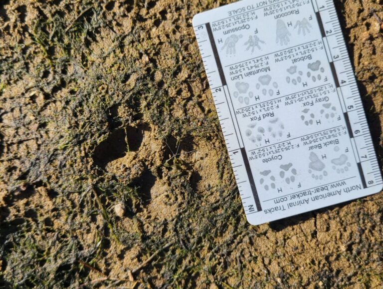
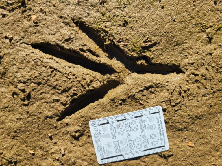
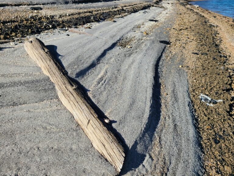
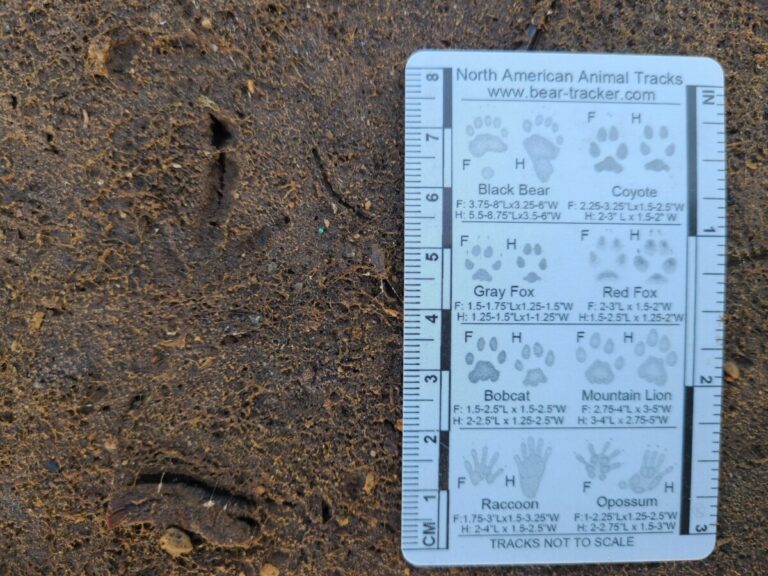
Featured Photo: An old front track of American Black Bear
Conditions looked good for a couple days of animal tracking, so I planned an afternoon of tracking at River Forks Park then a full day up at Lemolo Lake. It was interesting to see the similarities and differences. Enjoy!
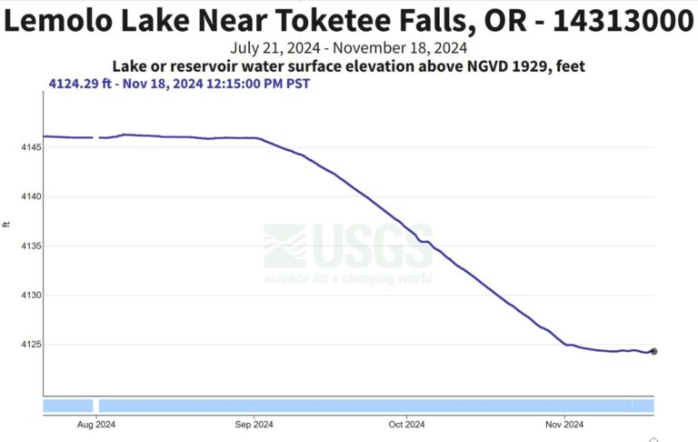
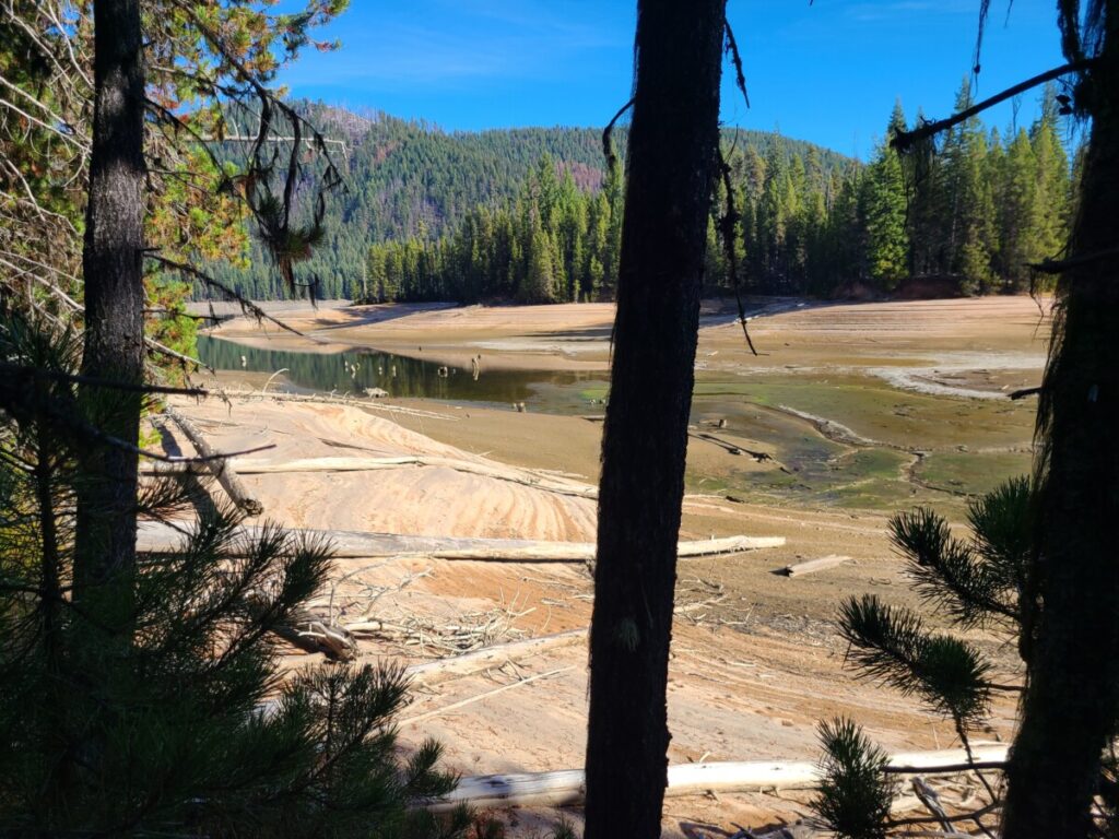
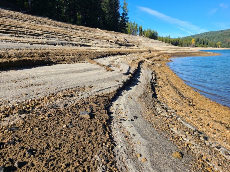
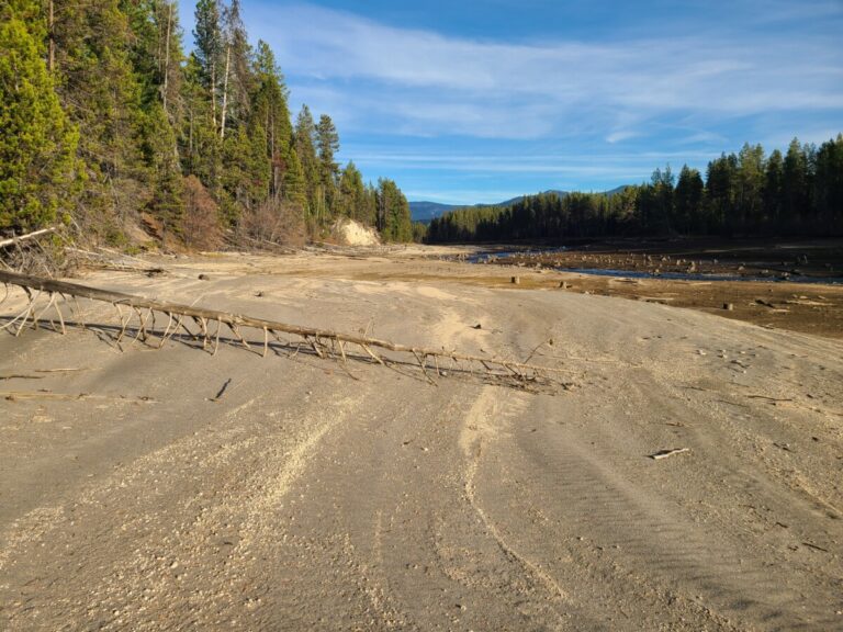
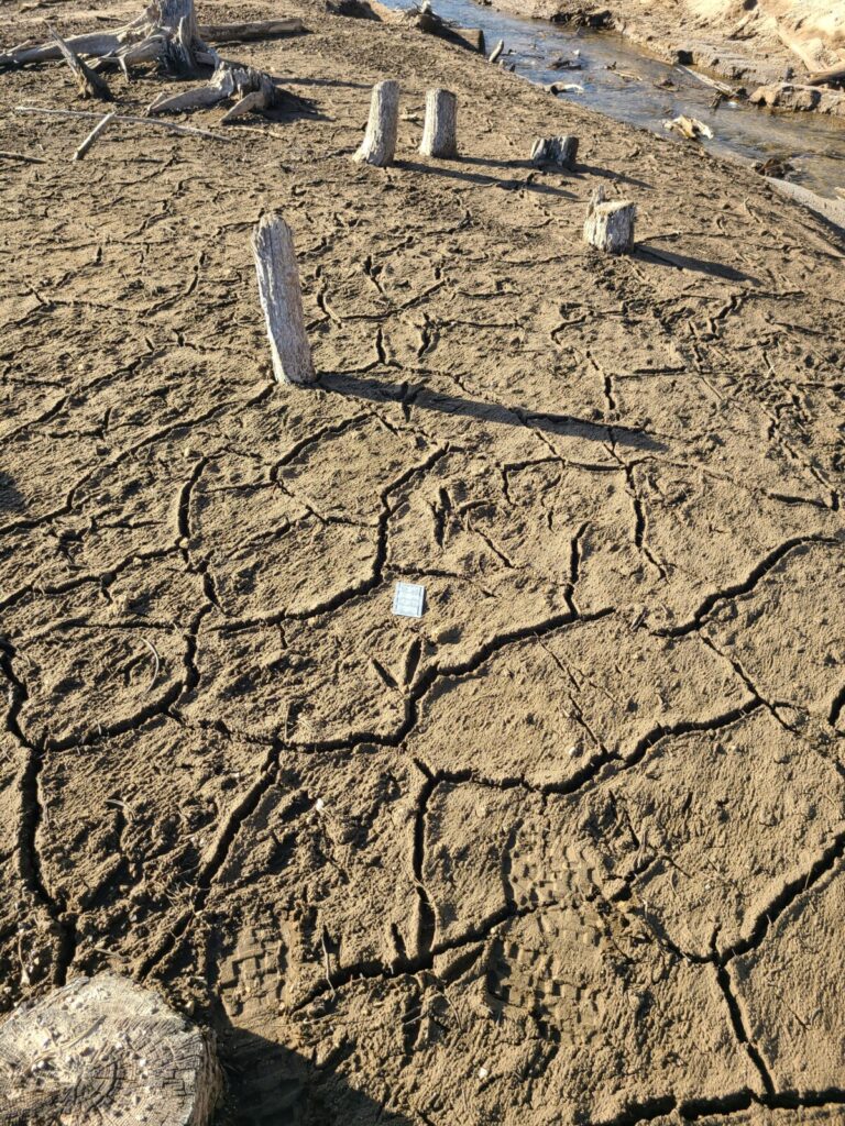
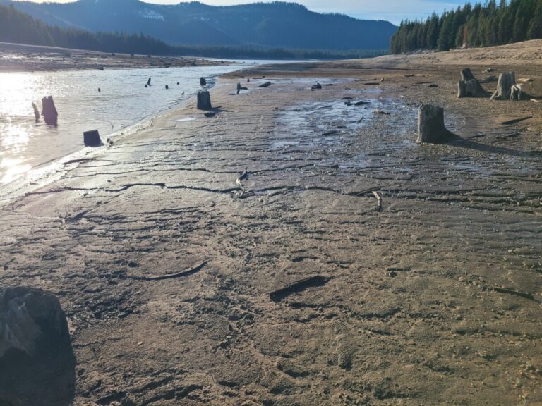
Lemolo Lake is located at about 4150 ft elevation in the Cascade Mountains of eastern Douglas County, Oregon. This reservoir was constructed in the 1950s for power generation with about 420 acres of surface area at full pool. Beginning Labor Day weekend, the lake level is lowered for power generation and flood control and drops 20-25 ft over the next 6-10 weeks. When I arrived on November 8, it was close to its lowest winter level. Flat areas near the reservoir edge were a nice fine sand. Sloped areas were terraced or stepped and composed of alternating bands of pumice gravel and sand of various textures and colors. At the lowest levels, which were again relatively flat in the upper reaches of the lake arms, were flats of mud, quite thick in places and sometimes difficult to walk in.
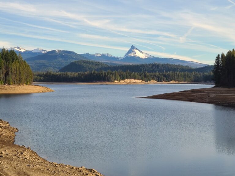
Lemolo Lake at near low pool, November 8, 2024. Mount Thielsen is in the background and some large ash/pumice cliffs can be seen on the far shore. Looking ESE from north end of dam.
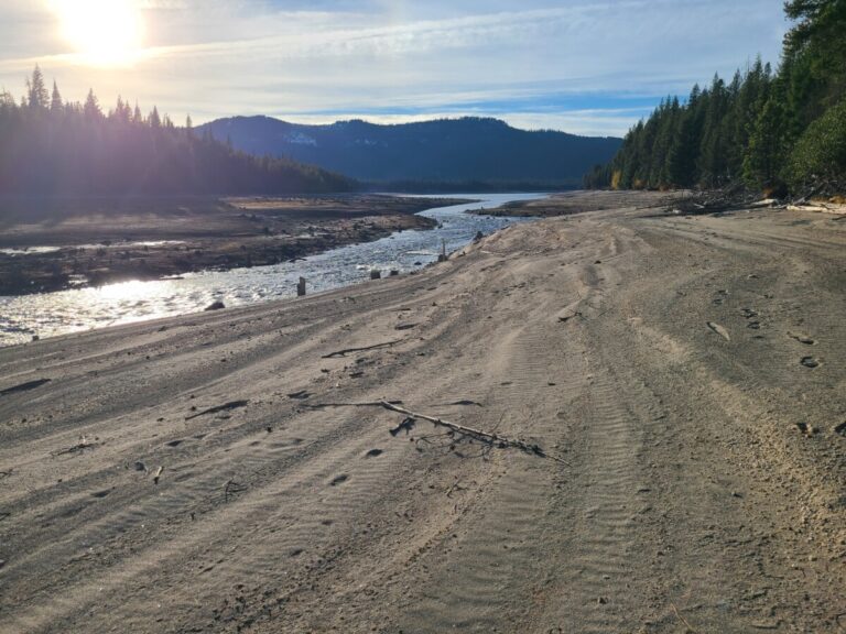
Water levels in the reservoir were lowered from early September to early November, 2024.
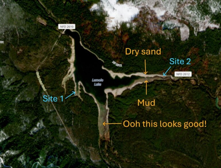
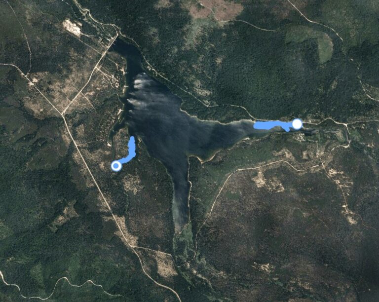
I visited two areas of the reservoir. One was a very small southwest arm and the other was along the north bank of where the North Umpqua River enters the reservoir. I was at each site for 2-2.5 hours, meandering around for 3/4 to 1 mile, respectively, though covering a straight-line distance of just a few hundred yards. It was a beautiful mostly sunny day. The images below show my eBird walking tracks and a low-res satellite image from Copernicus browser for November 7, 2024, the day before my visit showing the exposed shore and different habitats.
Low-res satellite image from Copernicus browser for November 7, 2024, the day before my visit, showing the exposed shoreline and different substrates.
Satellite image of Lemolo Lake and vicinity, with my tracking locations in blue. The satellite image has the water level at near full pool so does not show the exposed lake bed.
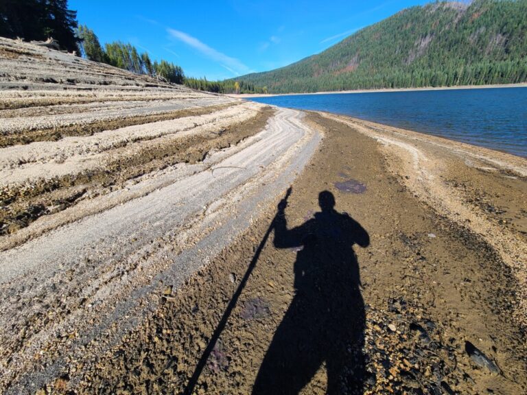
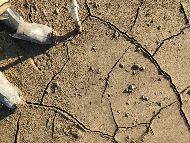
To reach my first destination in the southwestern small inlet I drove almost a half mile on a two-track native soil “road” accessed near the entrance to Pool Creek Campground (which was closed), until it turned into a hiking trail (43.307575, -122.193940). From there I hiked a couple hundred yards to the inlet, partly on trail and partly off trail. My first view of the exposed lake bed looked promising!
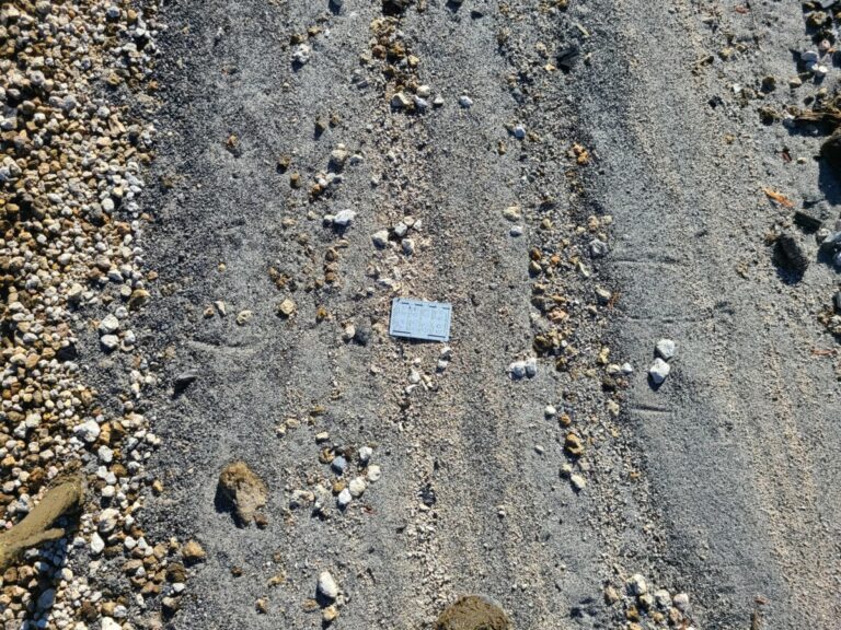
My first view of the lake bed, showing sandy shores and muddy bottoms.
Because the water level lowered over the course of nearly two months, the upper areas were dryer and had older prints (and a few new ones), while the lowest levels only had relatively recent prints, having been exposed less than a couple weeks. My first tracks on the way down into the area were waterfowl tracks: webbed feet of a medium-sized duck; not large like a Canada Goose or very small like Green-winged Teal. These tracks were many weeks old and were distorted by the shrinking mud.
Trail of medium-sized duck.
Print of medium-sized duck.
Wanderings of medium-sized duck or ducks.
Next were tracks of Great Blue Heron (presumed as Great Egrets are not regular here). These were also in the dry zone, and the shrinking mud created interesting alterations of the heron tracks, widening some of the toe prints. Sometimes it was easy to imagine additional tracks among the many shapes created by the cracks in the mud.
Old trail of a Great Blue Heron.
Old weathered track of Great Blue Heron.
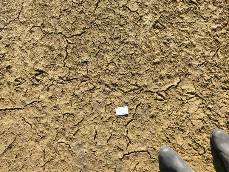
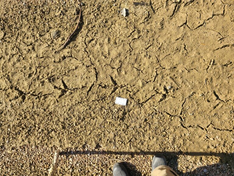
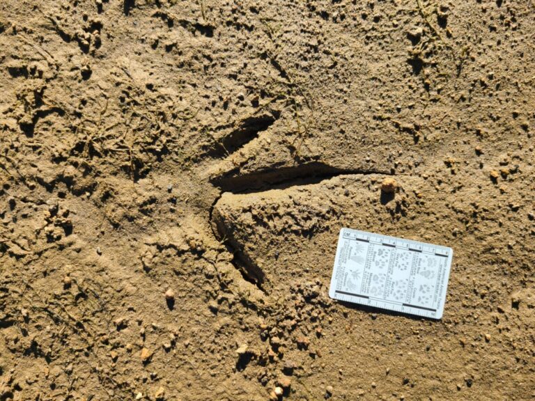
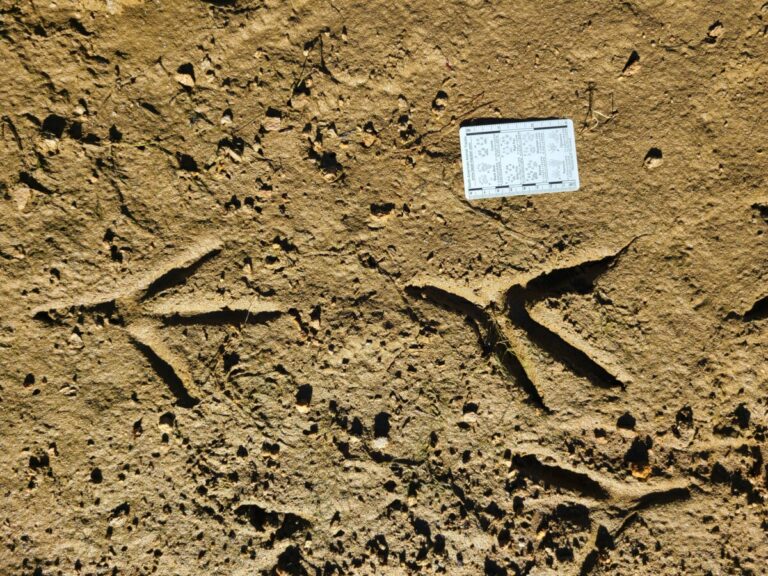
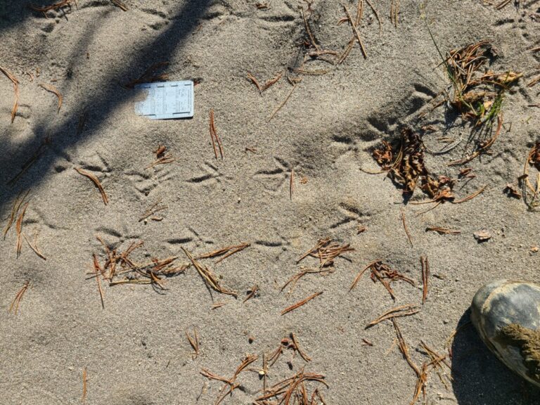
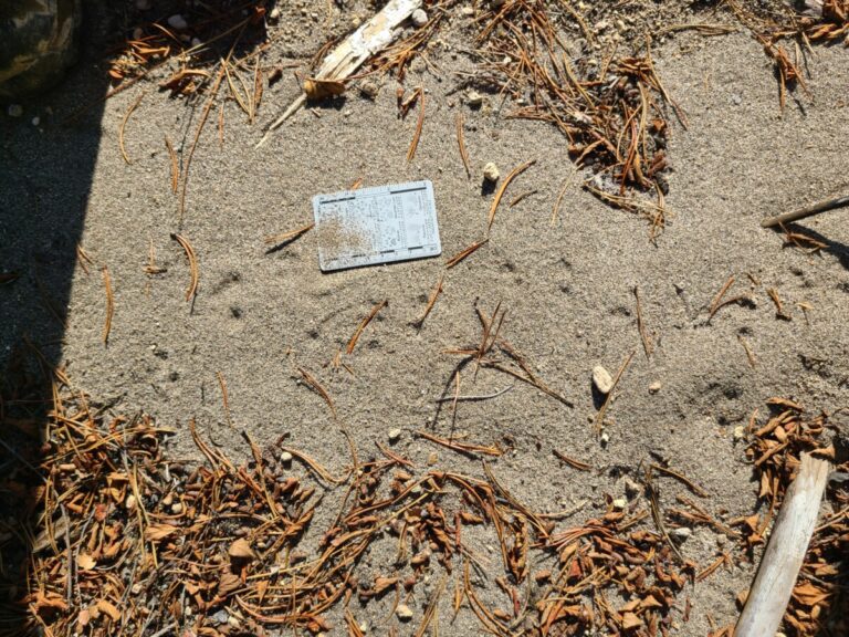
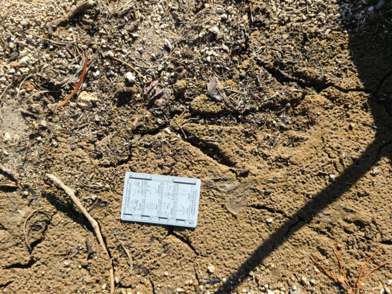
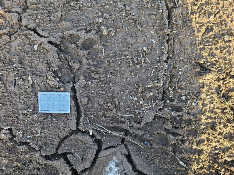
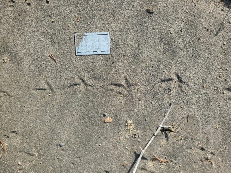
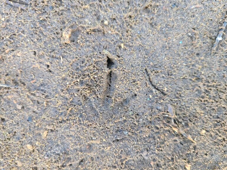
Hoping for some fresher tracks, I walked down to the more moist areas. And here I found my first mystery.
Unknown (at first) track.
Unknown (at first) track.
Unknown (at first) track.
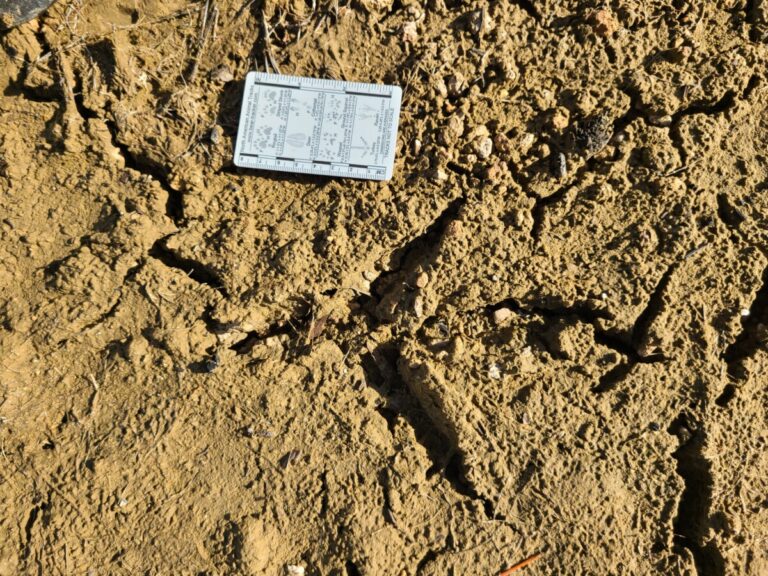
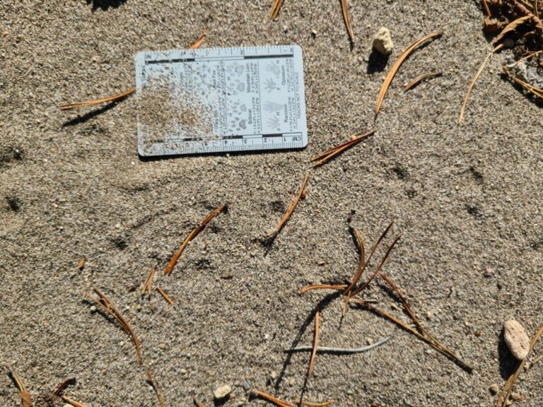
I stared and stared at this track and a few nearby it that were similar. I simply could not make sense of it. I thought I could see … maybe … some toes. Two together, and two separate? But they really didn’t come together to make a footprint, or even a double register of anything I was familiar with. Nothing made sense to me. I decided to follow the trail to look for a more complete track. I did decide that the direction of travel was toward the sun (as indicated by the shadow), because that is the side of the track where the cut in the substrate was made, with the compression behind/away from this side. The distance between each “mark” was about 8.0-8.5 inches with a trail width of about 3-4 inches, so when the tracks got faint, I could look where a track “ought” to be, find faint impressions and continue on the trail. Nevertheless, I did eventually lose the trail as it continued up into drier substrate. So, I decided to backtrack.
Mystery track crossing the trail of a Great Blue Heron.
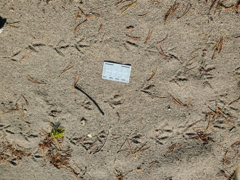
Backtracking the mystery track.
Distance between marks about 8-8.5 inches.
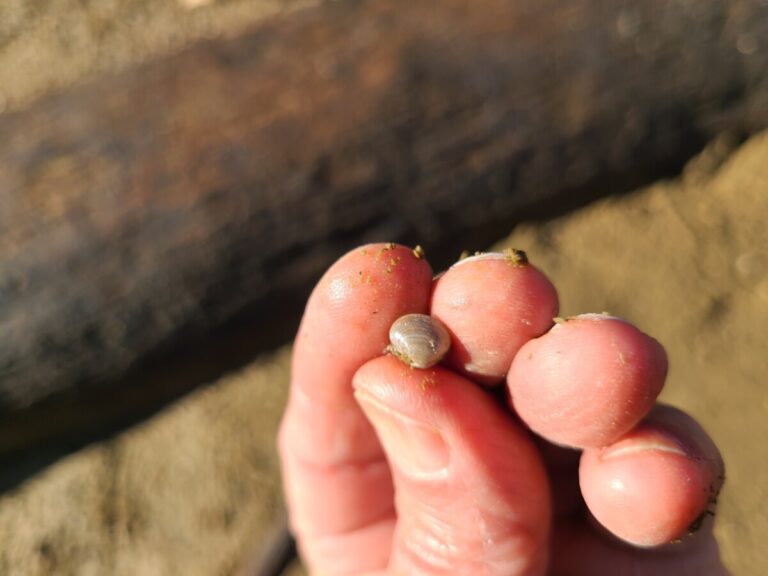
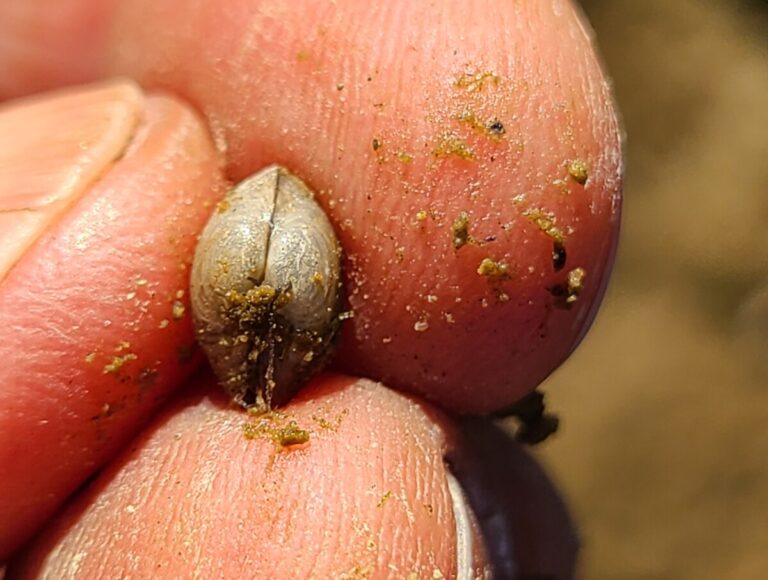
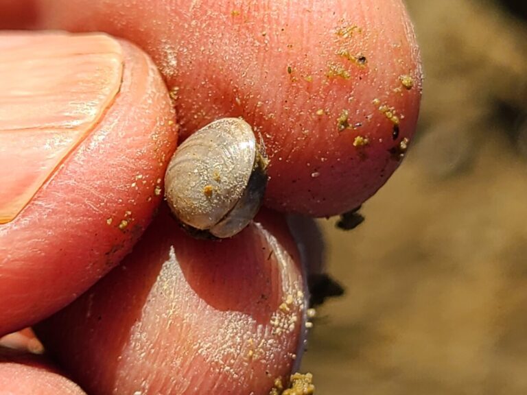
While backtracking I found a tiny clam as well as plenty of Great Blue Heron tracks.
Pea Clam (Family Sphaeriidae)
Pea Clam (Family Sphaeriidae)
Pea Clam (Family Sphaeriidae)
Great Blue Heron track.
Great Blue Heron trail.
Great Blue Heron track.
Great Blue Heron tracks.
Great Blue Heron tracks,
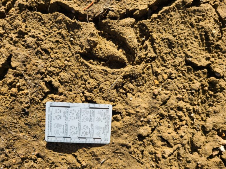
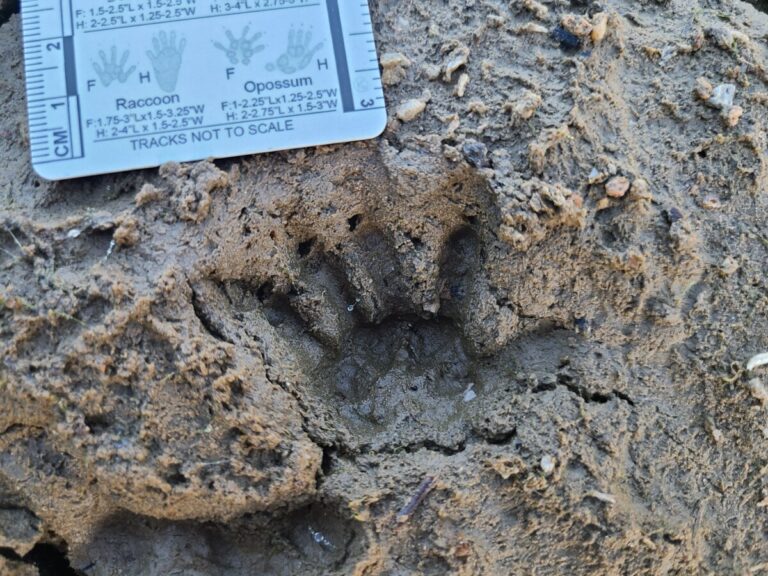
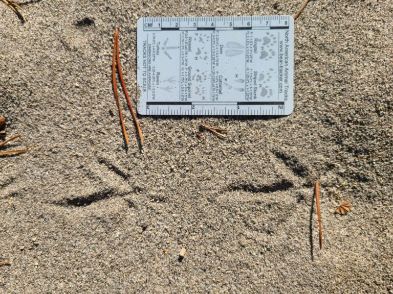
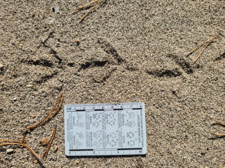
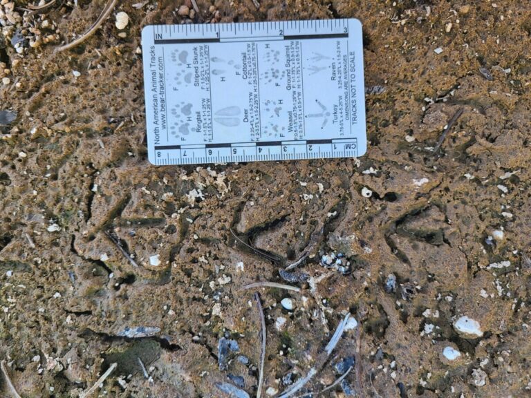
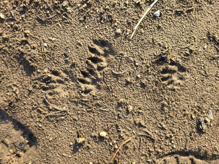
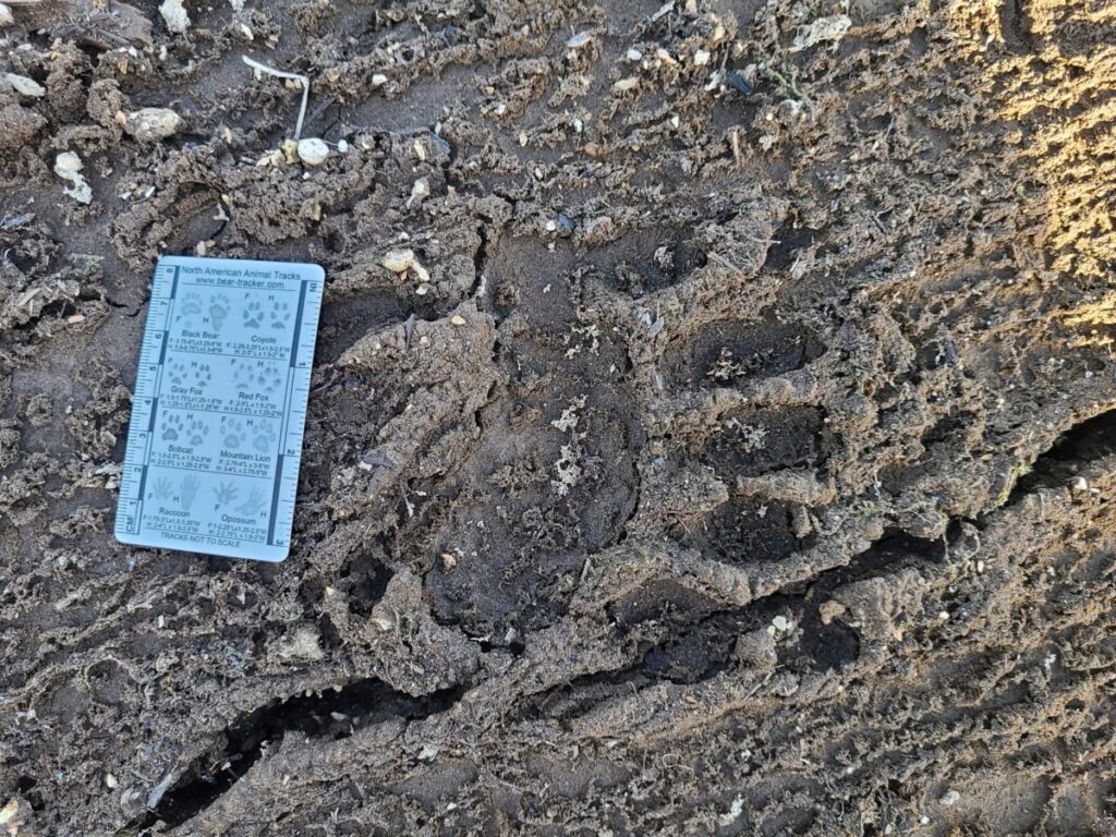
After 5-10 minutes of backtracking, I was beginning to see more of the track. Then,in mud of just the right consistency–not too stiff, not too gooey–I was rewarded with some pretty full tracks! Not 100% showing all toes distinctly, but plenty enough! Mystery solved! I laughed to myself and felt the joy that comes when perseverance and determination pays off and I learn something new!
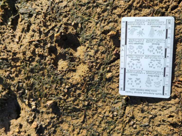
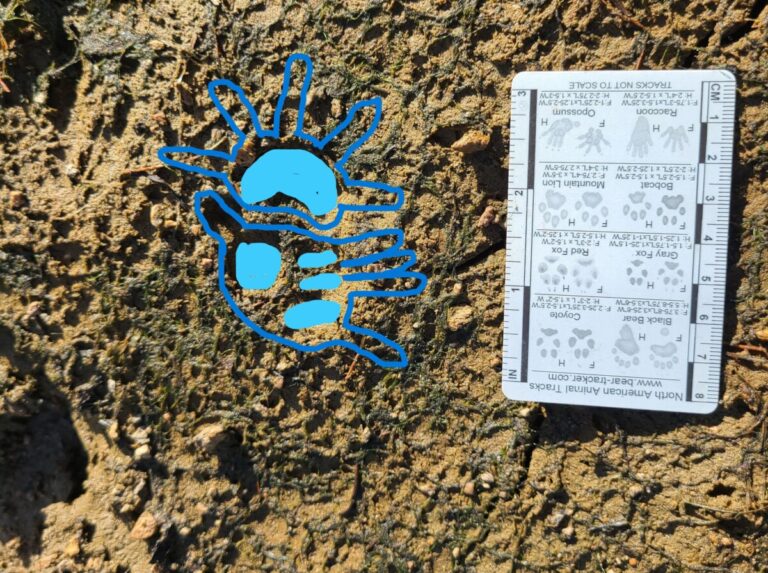
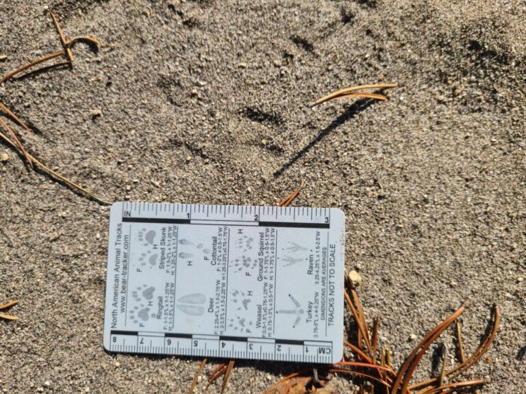
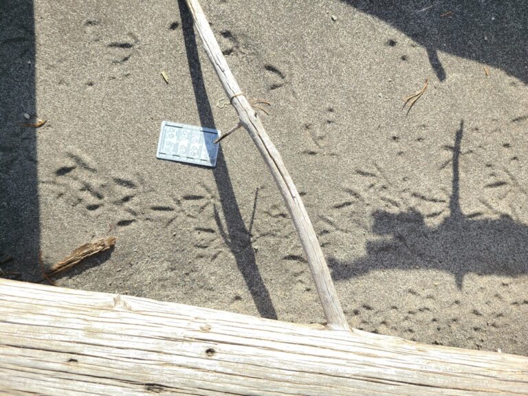
Virginia Opossum tracks. One set above the card, one set below. Each set has the front foot ahead of the hind foot. Upper set is right feet, lower set is left feet. The front feet are fingery and splayed (moreso on the upper track in this photo). Rear feet are just behind and the distinctive thumb is visible on the upper hind track, but not very apparent on the lower track. The card in the photo has a drawing of right-side opossum tracks in the lower right of the card, for comparison.
Left front opossum track with left rear pad partly obscured in lower left.
Opossum track, right front and hind.
Opossum tracks, two sets.
Opossum tracks, right side, front and hind tracks.
Opossum tracks, right side front and hind. Notice dimple from tip of thumb facing top of image.
Opossum tracks, two sets, traveling right.
Opossum tracks, front and hind, traveling right, thumb pointing up in image.
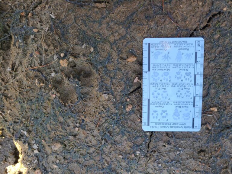
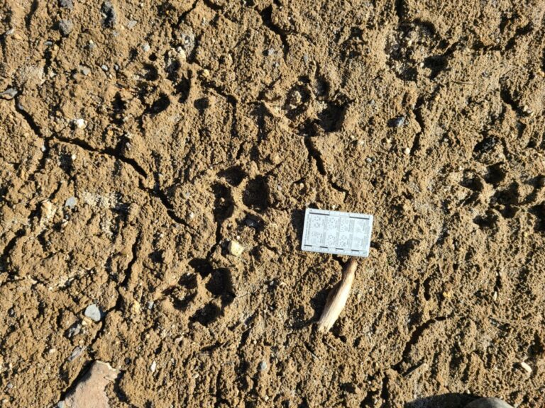
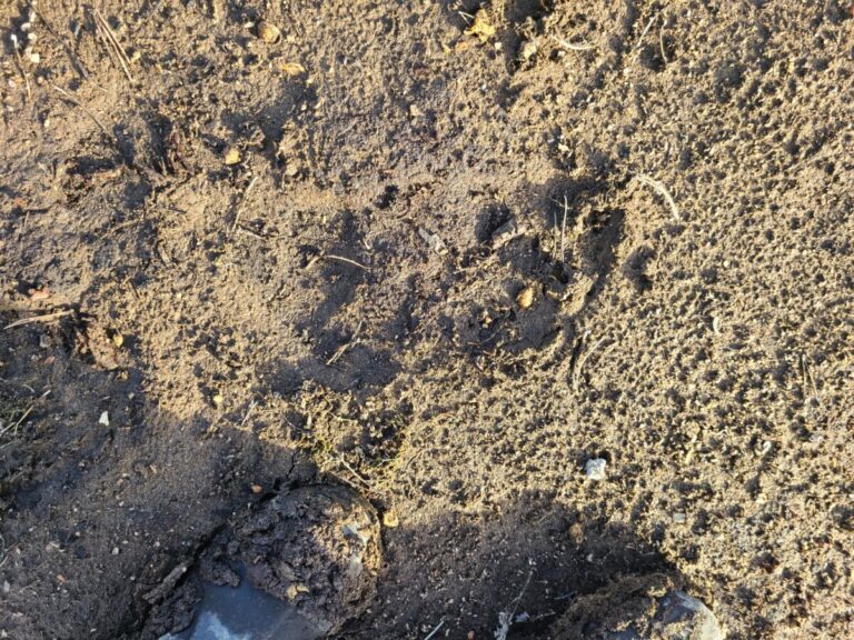
Using these more full tracks, I could then interpret the “mystery tracks” I had seen originally. Below are duplicates of one of my original “mystery” images, one without annotation and one with the foot of an opossum marked over the track. Note that for the most part, only the metacarpal and metatarsal pads registered in this substrate and no toes were visible. To my inexperienced eye, it made it look like the meta-pad impressions were some kind of toes and they made no sense. But now that I understand the configuration of meta-pads and typical print placement in an opossum walk, these make sense.
Interestingly, this is the highest elevation and farthest east into the western Cascades that I have detected Virginia Opossum in Oregon, and it appears to be the highest elevation observation for the species of over 500 Oregon reports in iNaturalist.org. Of course they are most common at low elevations, as are humans, so that is where most of the reports come from.
Opossum feet marked over previously unknown track. The bright blue are the metacarpal pads that created the track I could see.
Unknown (at first) track.
I had about another half-hour before I wanted to go over to my second spot, so I looked around for more tracks as well as admired the artistic terracing of the sloped lake bed.
Medium-sized duck trail. The "pigeon-toed" walk is very apparent.
Medium-sized duck tracks.
True fir (Abies sp.) seed. There were several that had helicoptered down from a nearby tree.
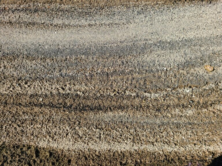
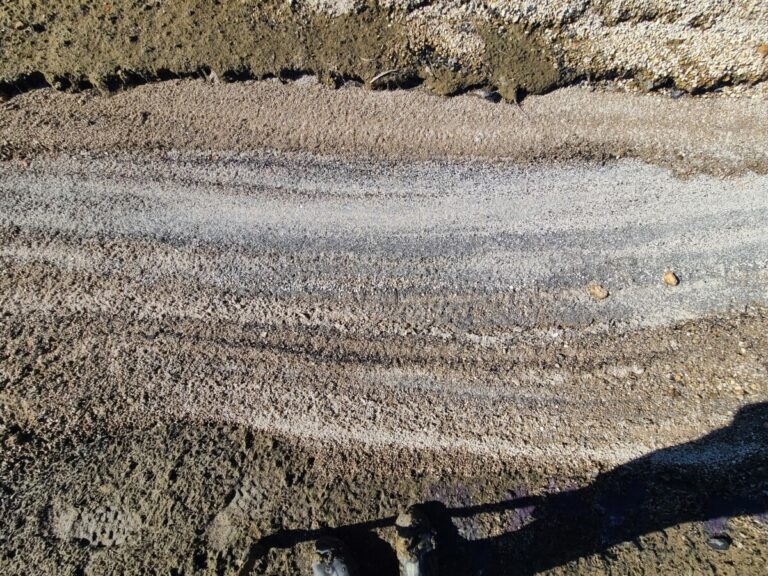
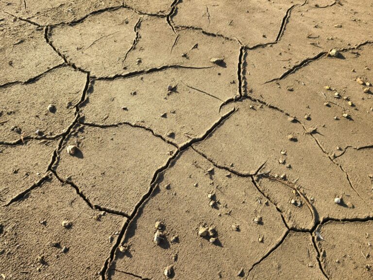
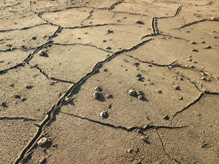
The patterns, colors and textures of the terraced exposed lake bed were beautiful and interesting. In steps it alternated sand, pumice, sand, pumice, and even the sand had gradations of color.
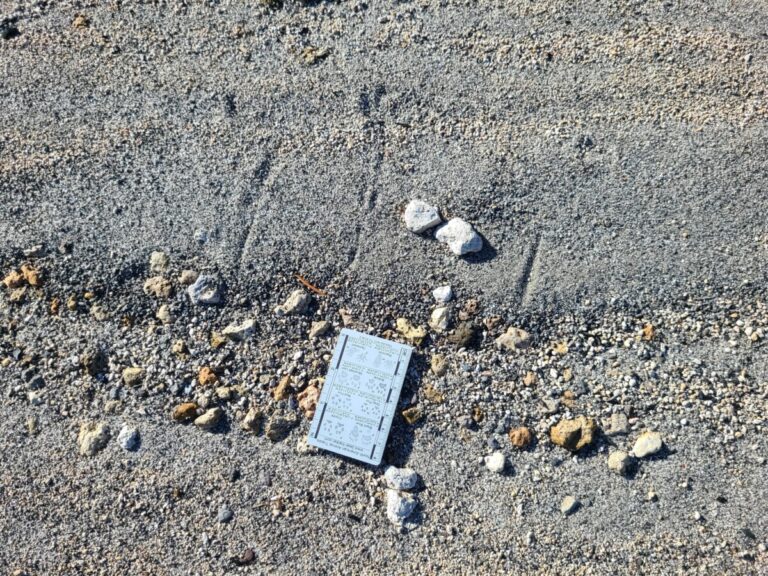
I didn’t see much in terms of discernable tracks on this terraced slope, except for those of a Common Raven. It looked like the raven landed on one level, then hopped up to the next level, making a slight scrape in the sand with its right wing.
Common Raven prints (above and left of card) and possibly a wing scrape above and right.
Here you can see Common Raven prints on the left, downslope from the prints (and possible wing scrape) on the right. My interpretation is that the raven landed on the lower level then hopped up to the next level.
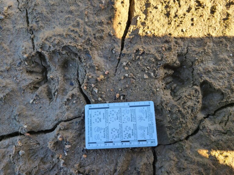
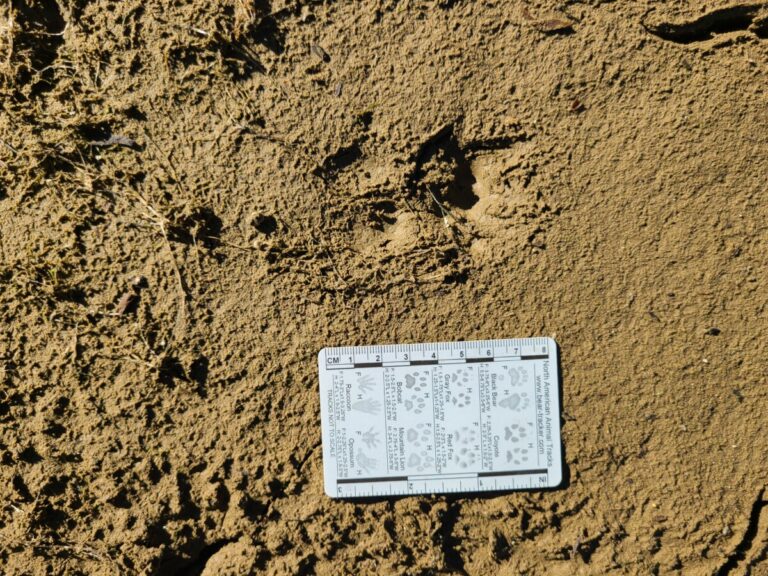
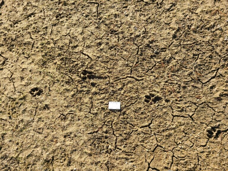
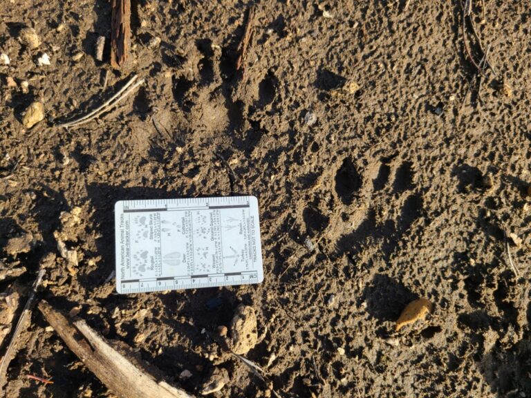
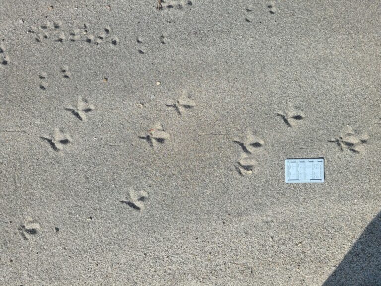
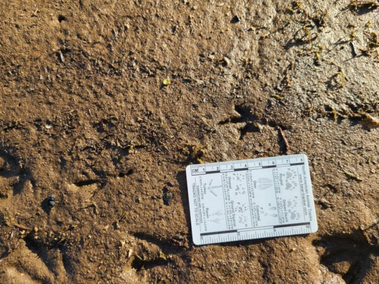
Well, it was time to move on to my next spot. On the way back, I noticed these three-toed dog tracks. I don’t understand why some of the tracks ended up looking like three toes vs. four. Perhaps it was due to some toe slippage in the mud. Let me know what you think.
A three-toed dog track?
A three-toed dog track?
Not that the two farthest left tracks show four toes, while the other two show what looks like only 3 toes.
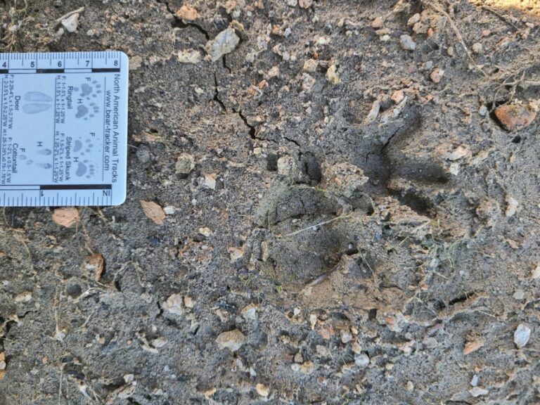
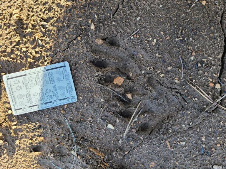
Also on the way back were what looked like possible Coyote tracks, with fairly tight toes compared to the dog track I had just seen.
Coyote? Or medium-sized dog?
Coyote? Or medium-sized dog?
Coyote? Or medium-sized dog?
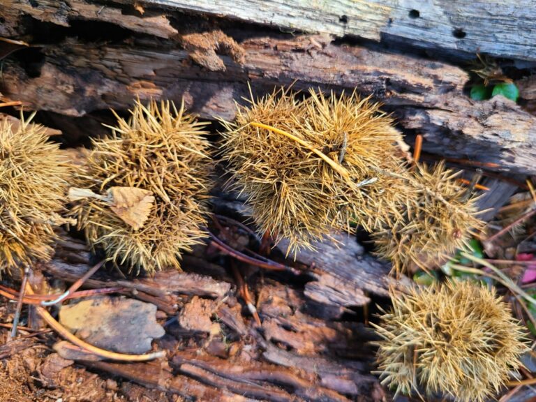
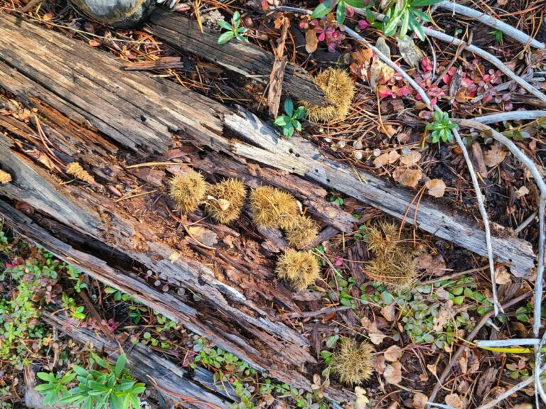
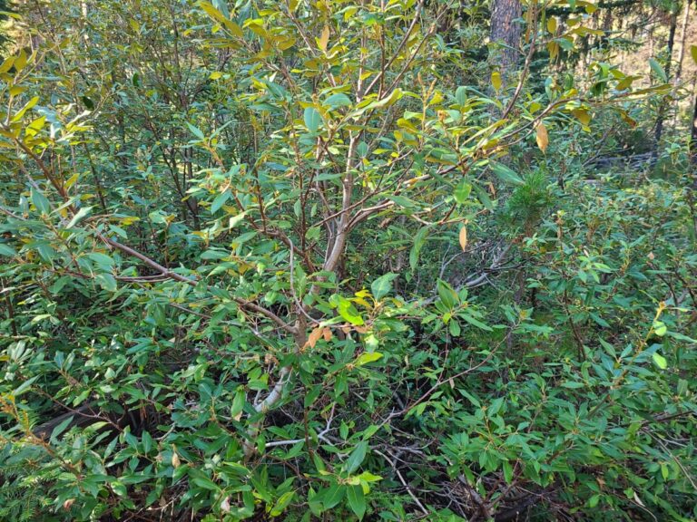
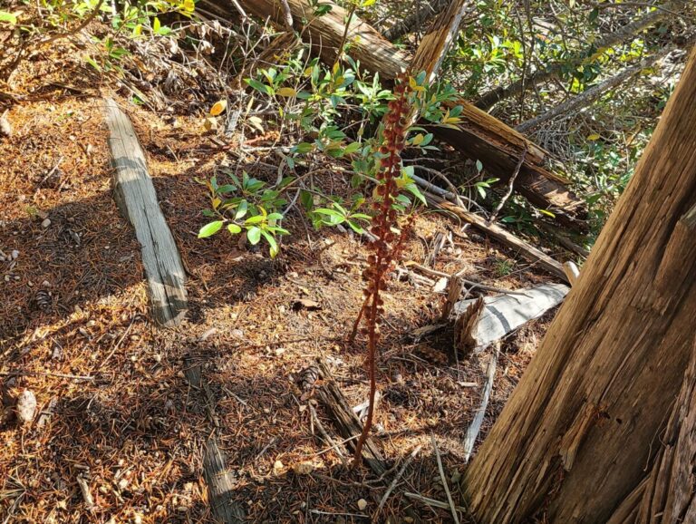
On my way back through the woods to the pickup were some Golden Chinquapin burrs/seedpods and some Woodland Pinedrops.
Golden Chiquapin burrs
Golden Chiquapin burrs
Golden Chinquapin
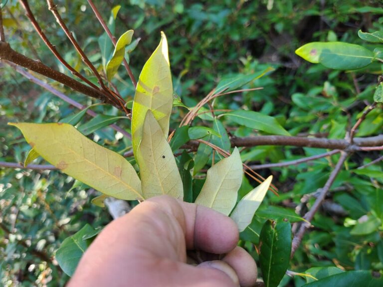
Golden Chiquapin showing "golden" underneath the leaves.
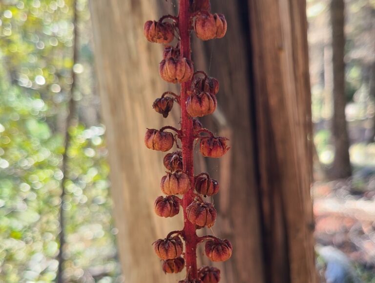
Woodland Pinedrops
Woodland Pinedrops
On the way over to the next spot I stopped near a bridge where Lake Creek flows on its way to the largest south arm of Lemolo Lake. The water was swift, cold, and clear. Here were some fun plants and some bird and invertebrate sign.
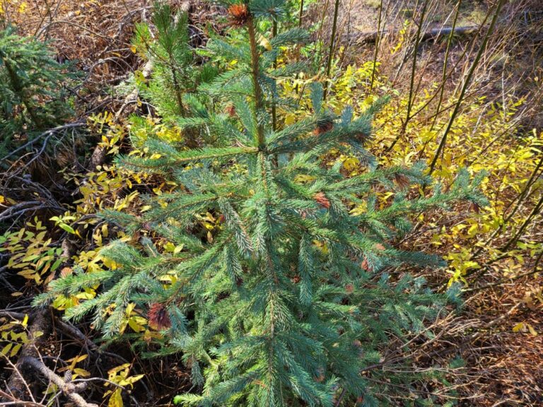
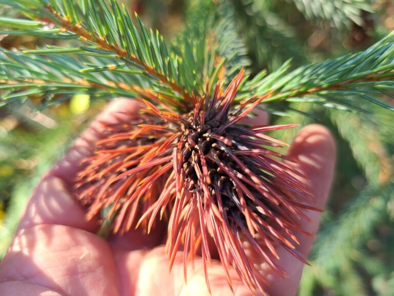
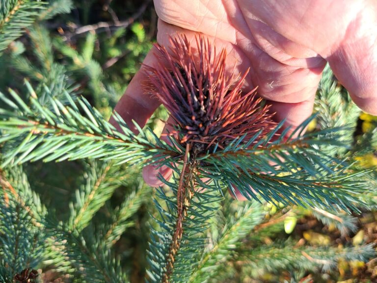
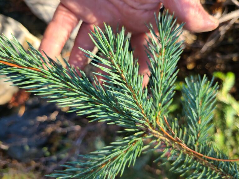
Sapling Engelmann Spruce infected with Spruce Gall Aphid (Adelges sp.)
A gall caused by a Spruce Gall Aphid (Genus Adelges), on Engelmann Spruce.
A gall caused by a Spruce Gall Aphid (Genus Adelges), on Engelmann Spruce.
A sprig of Engelmann Spruce
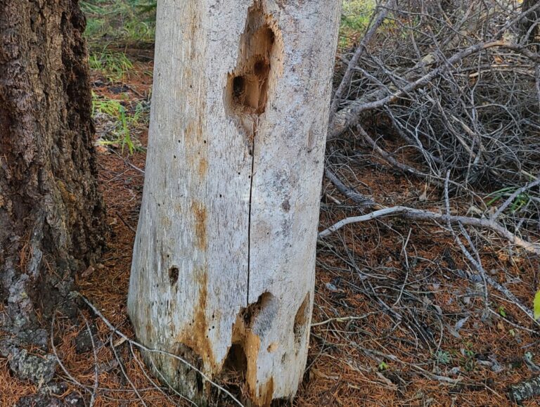
Feeding sign of Pileated Woodpecker in old snag.
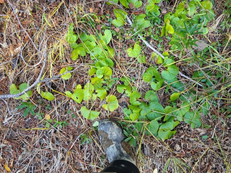
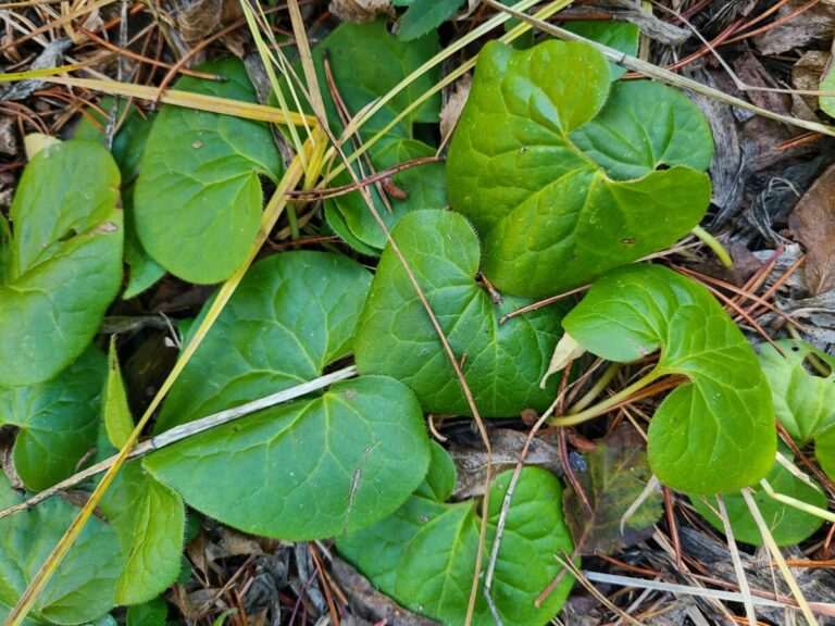
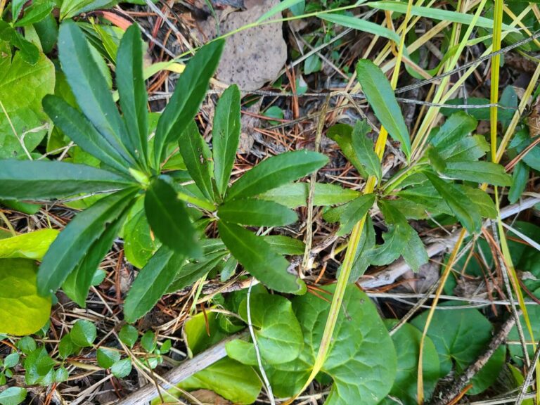
Western Wild Ginger
Western Wild Ginger
Pipsissewa (Prince's Pine)
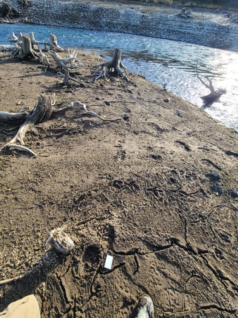
I arrived at the second location just before 1:30 pm. There are several access points to the north side of Lemolo Lake here, starting about 0.5 miles west of the bridge over the North Umpqua River near Inlet Campground. I parked at one of the smaller pullouts and walked about 50 feet to the sandy flats along the forest edge.
Second location, looking east.
Second location, looking west.
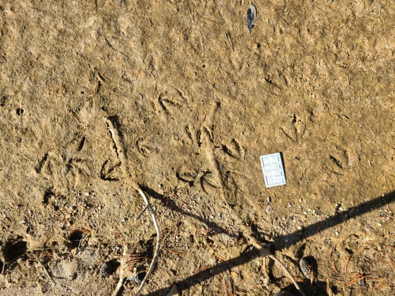
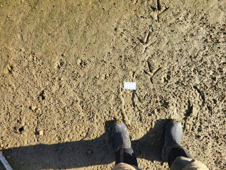
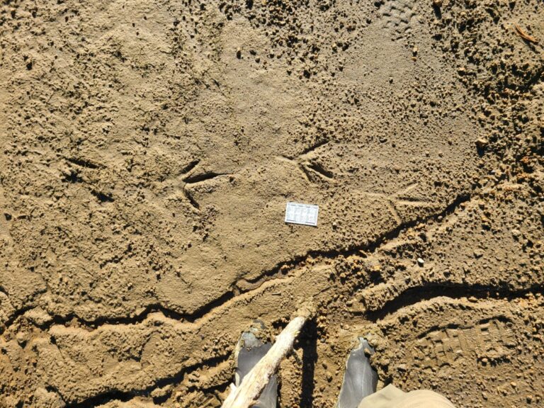
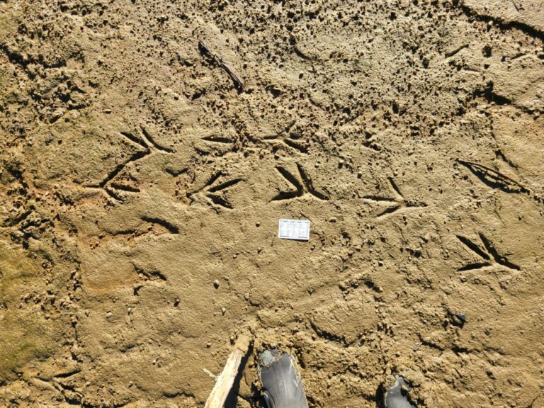
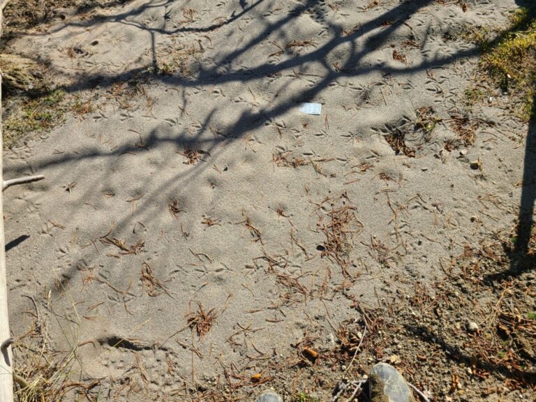
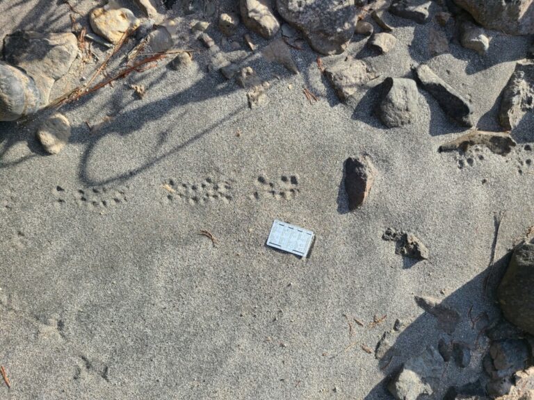
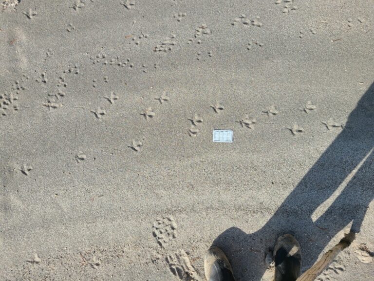
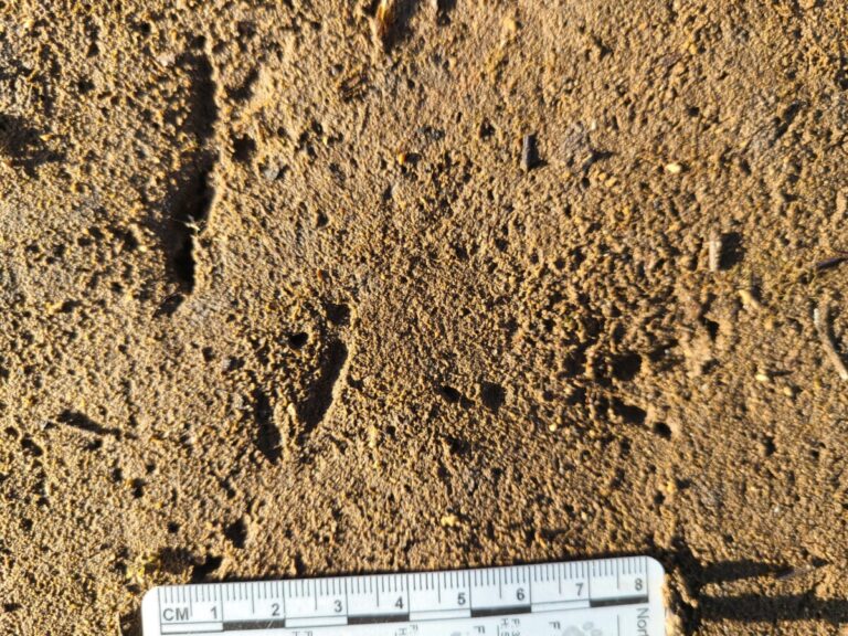
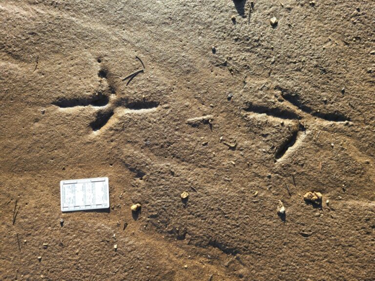
Immediately at the edge, where the lakeshore meets the forest, were hundreds of grouse and mouse tracks in the sand among the down trees and other sparse cover. During my two hours exploring this area, every time I went back to the sandy edge next to the forest there were grouse and mouse tracks. Neither extended more than about 20 feet from the forest lake edge and were always associated with the dead down trees or shrubs, presumably for protective cover. There are two species of grouse in the area, Ruffed and Sooty. I’m guessing these are Ruffed Grouse due to small size and being in a lowland area near water, but I’m just playing probabilities. The “mouse” tracks are probably those of Deer Mouse versus a vole, due to the bounding pattern, wider separation of rear feet, and open habitat, but correct me if I’m wrong.
Edge of exposed lake bed showing sandy flats with down dead trees and shrubs on the bank. Grouse and mouse tracks were confined to this zone.
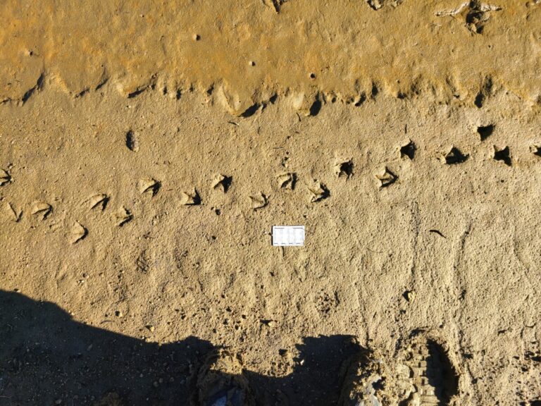
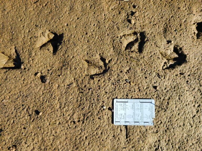
Many grouse tracks, all traveling left.
Grouse tracks.
Grouse tracks.
Mouse tracks.
Mouse tracks.
Mouse tracks.
Grouse tracks.
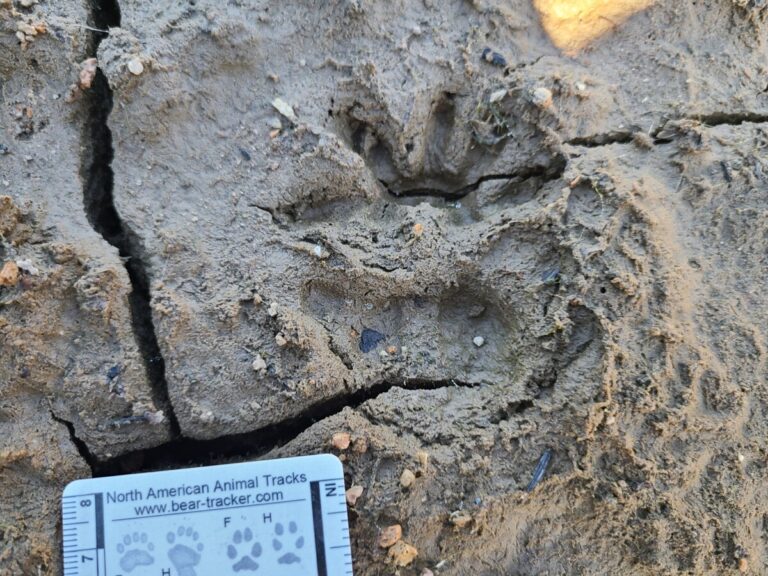
Just beyond this zone of great cover for mice and grouse, but before the sticky mud, were some deer tracks, out in the zone of easy walking. In this vicinity there are only Columbian Black-tailed Deer. The tracks were fairly old, partly filled in with sand, needles, and other debris, so I’m guessing 2-4 weeks old. Also nearby, in the “older” section of the exposed lake bed, where it has been exposed for at least a month, were some older Great Blue Heron and sandpiper (probably Spotted Sandpiper) tracks.
Deer track filled with debris.
Deer track with most debris removed.
Deer track filled with debris.
Deer tracks.
Partly obscured Great Blue Heron track, much of it filled with debris.
Sandpiper tracks, probably Spotted Sandpiper, showing a bit of debris as well as cracked mud within the track since the track was made (because the bird would not make tracks like these under current substrate conditions).
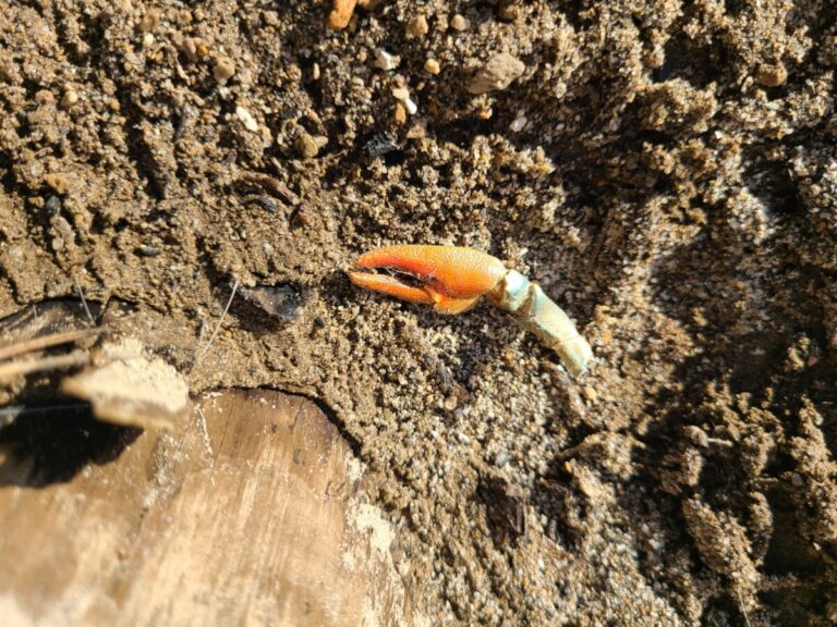
Still on somewhat medium to high ground were some dog and barefoot human tracks, Canada Goose tracks, and a Signal Crayfish claw.
Domestic dog tracks
Domestic dog and barefoot human tracks.
Canada Goose tracks.
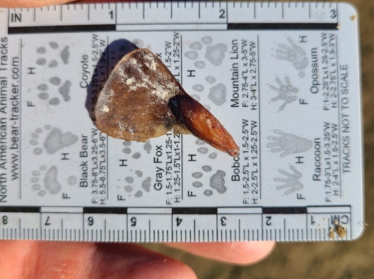
Signal Crayfish pincer arm, possibly scraps from otter foraging, but lots of things like to eat crayfish.
This Great Blue Heron trail led me down closer to the water….
A Great Blue Heron trail, imprinted while the mud was still wet.
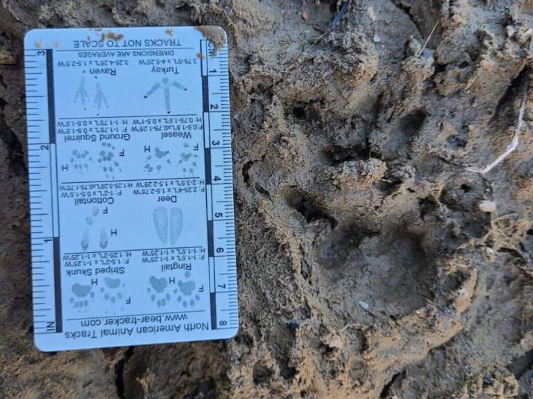
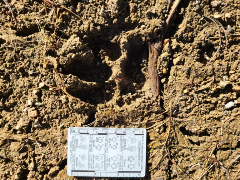
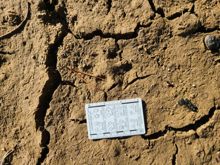
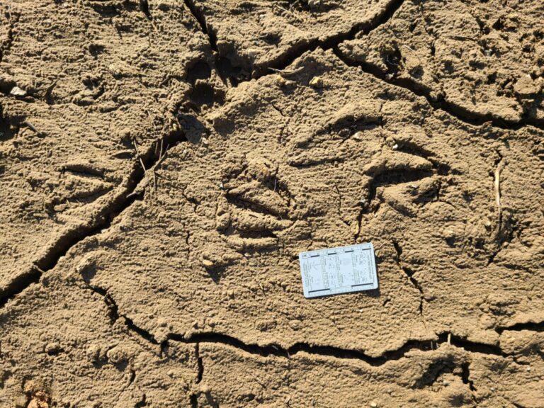
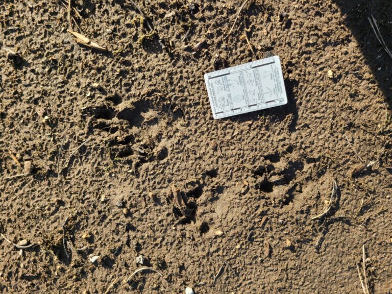
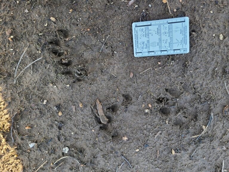
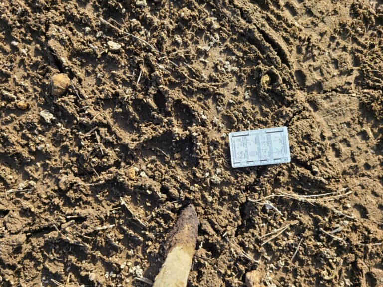
Oddly, it appeared that the “three-toed dog” from the previous spot had followed me here. Well, okay, the track is a few weeks old. And, I’m wondering if this is a bear track that has been partly covered up. Look at the extent of the pad. And, oddly, it looks like both tracks have a mound of mud covering up the left side of the track. What’s going on there? Let me know what you think.
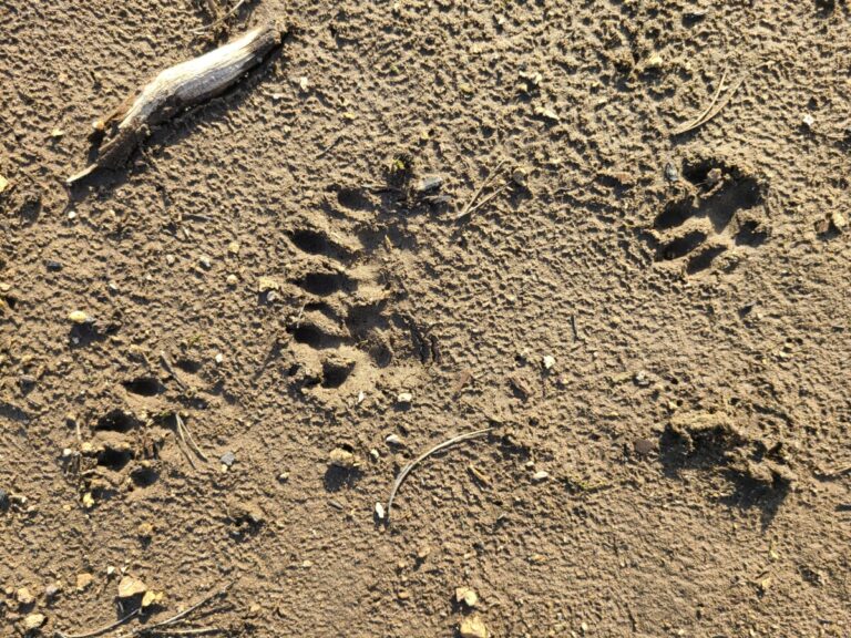
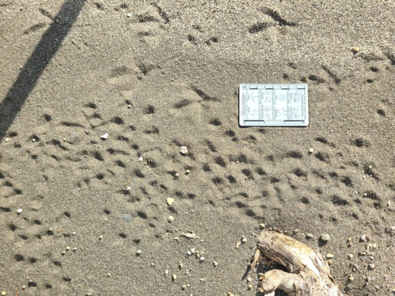
I finally made it down to some impressionable mud. Here I was rewarded with several trails of Northern River Otter tracks. One trail had its own path, while two others were intertwined as they all headed ESE and finally jumped into the river.
Northern River Otter tracks
Northern River Otter tracks
Northern River Otter track
Northern River Otter tracks
Northern River Otter tracks
Northern River Otter tracks
Northern River Otter tracks
The last tracks before this otter dove into the river.
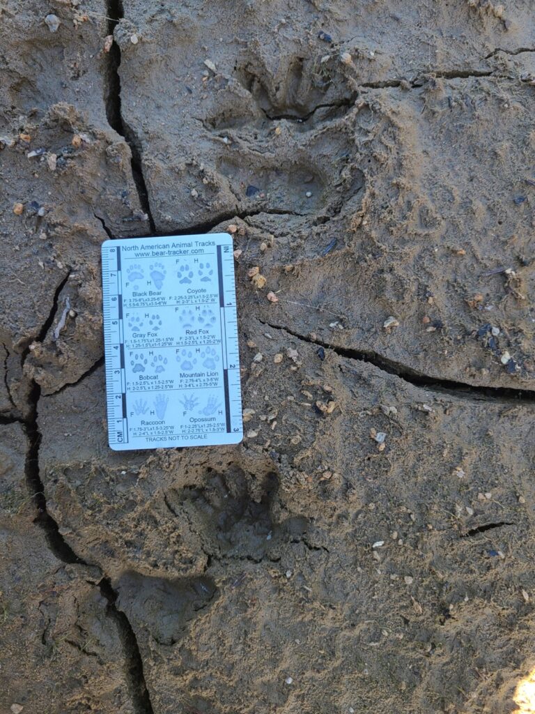
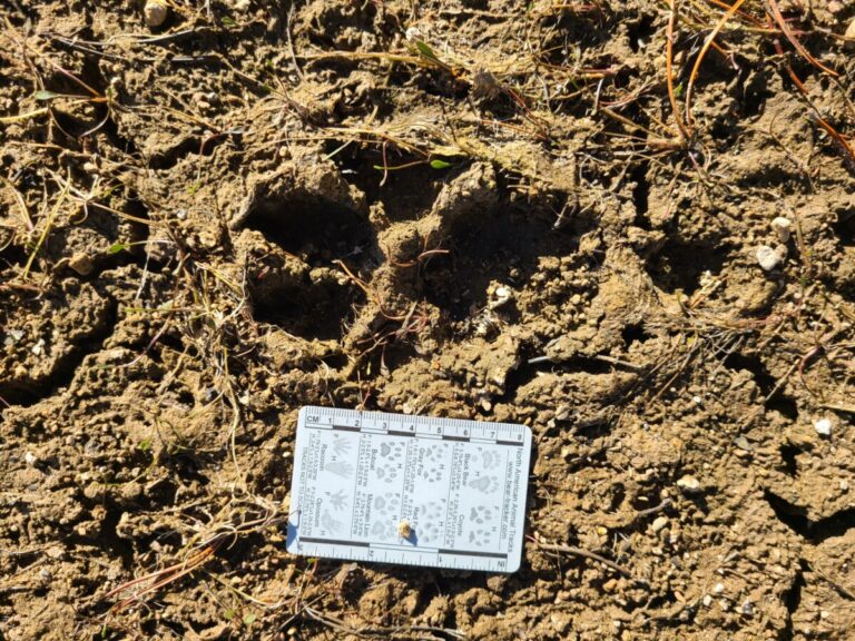
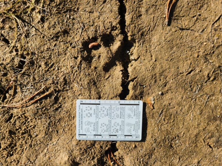
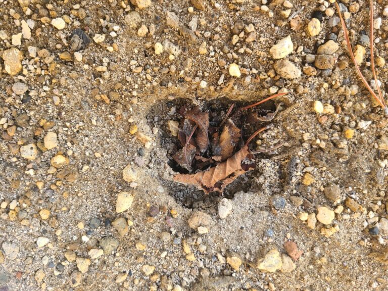
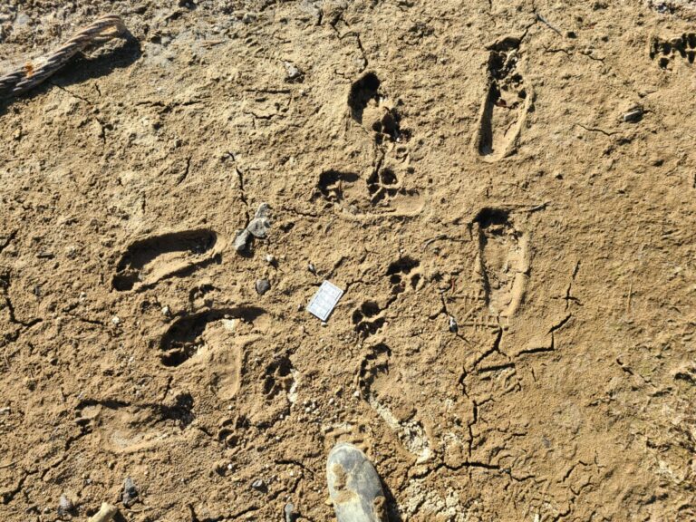
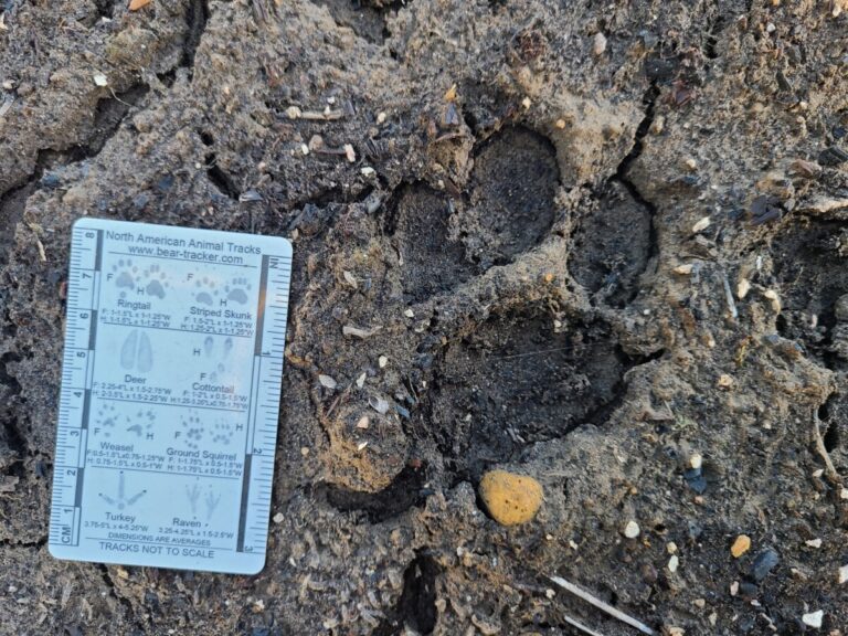
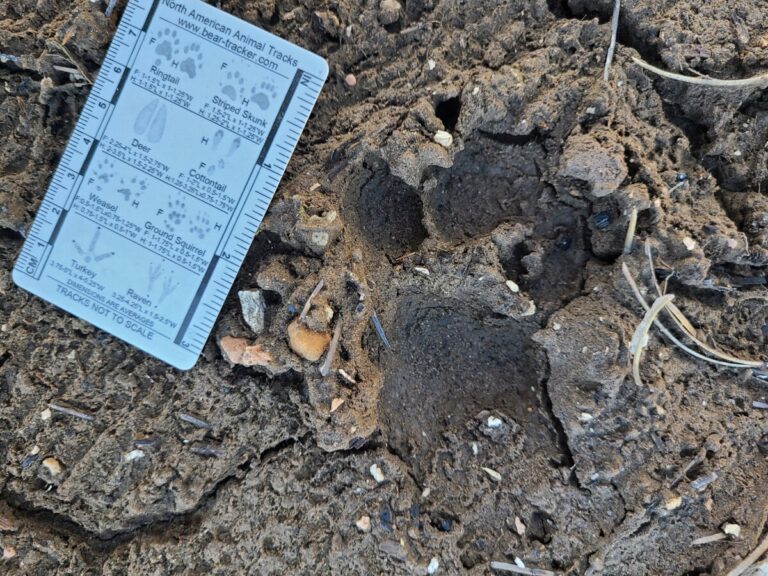
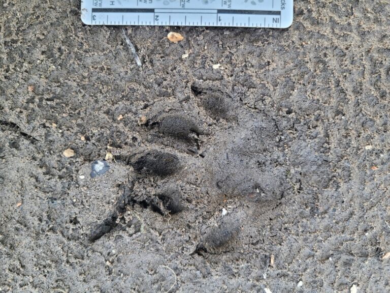
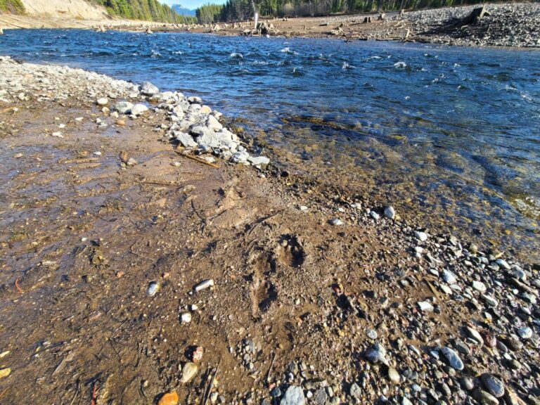
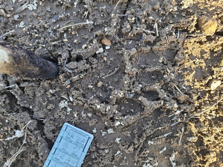
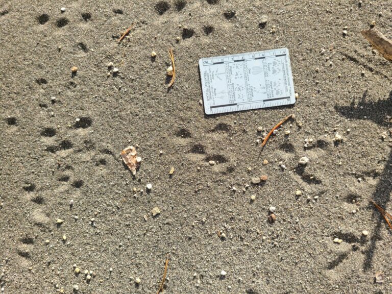
As I followed the otter trails back and forth all over this area of mudflat, something in the dry cracked mud held my gaze. Was this a track? Was it just a random creation of shapes? As I stared, it began to take shape. Was it a barefoot human? I looked for the trail and other tracks. Turns out it was an American Black Bear. These tracks were perhaps a couple weeks old, maybe more. Once I trained my eye to the trail, starting with the clear tracks, I could see the worn depressions where the bear made its way down to the water. I wouldn’t be surprised if it swam the river and went up the other side, but I didn’t have time that day to try to pick up the tracks on the other side.
The first bear track that caught my eye.
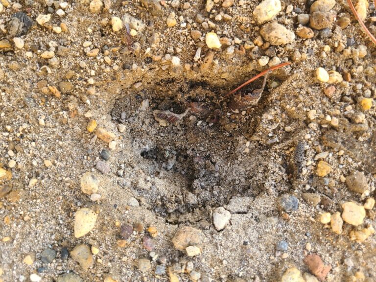
The same track in the shade.
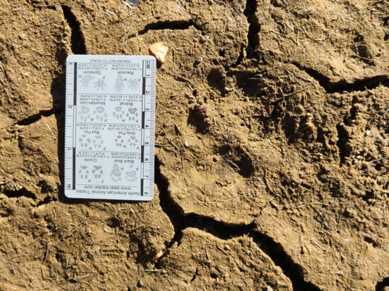
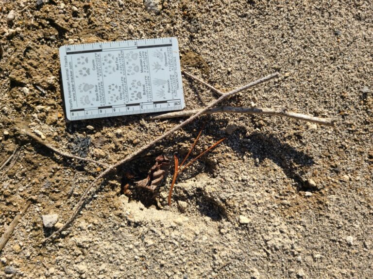
Black Bear track.
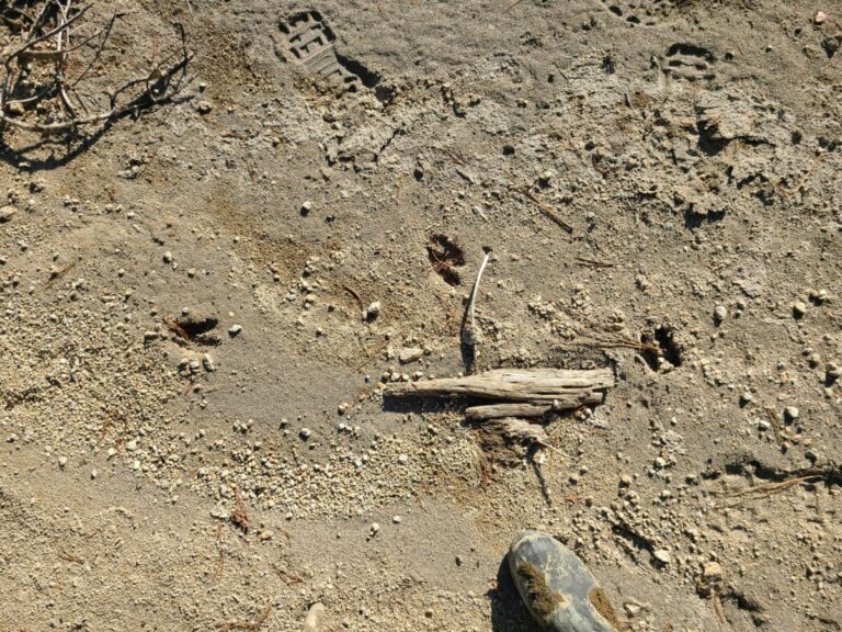
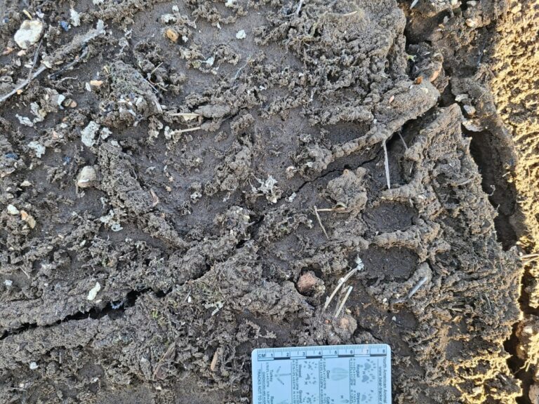
Black Bear tracks.
Close-up of Black Bear track.
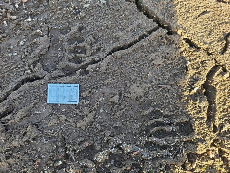
Another pair of Black Bear tracks.
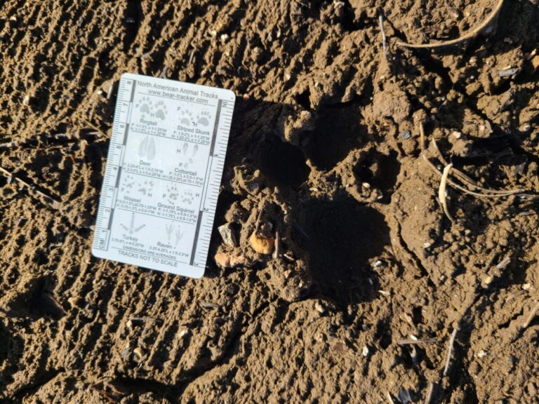
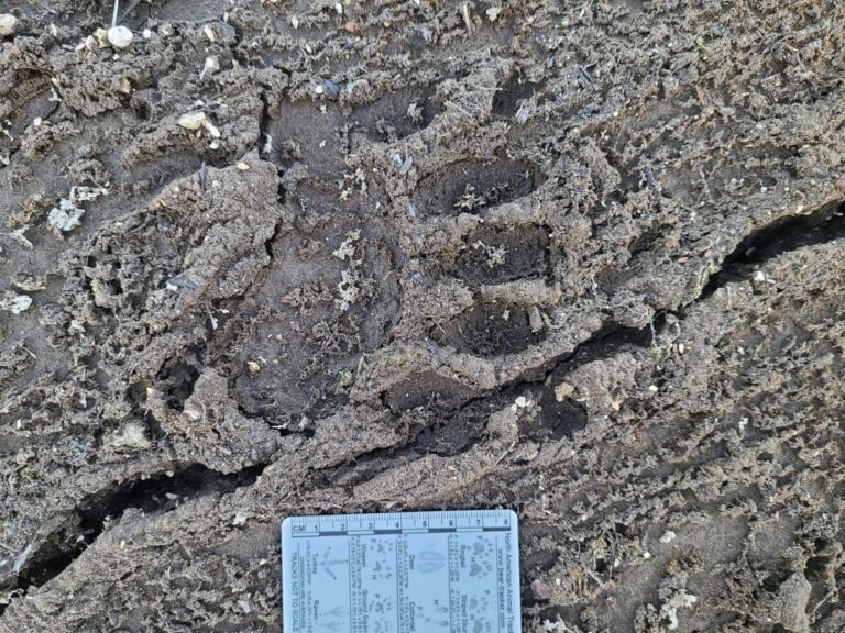
One of the more obliterated sets of tracks along the trail as it neared the water. Perhaps this track was made underwater, which washed it out before the water level lowered to expose it.
I considered the change in the track condition, from old but fairly clear, to being merely depressions without detail. I suspected that where the obscure tracks began, the bear was walking in very shallow water which probably had some current being this close to the main river channel. The slowly moving water likely removed the detail of the tracks, leaving only depressions, before the water level continued to descend and finally exposed the trail.
Deteriorated and diminishing tracks of American Black Bear as it walked toward the river. My tracks cross right to left.
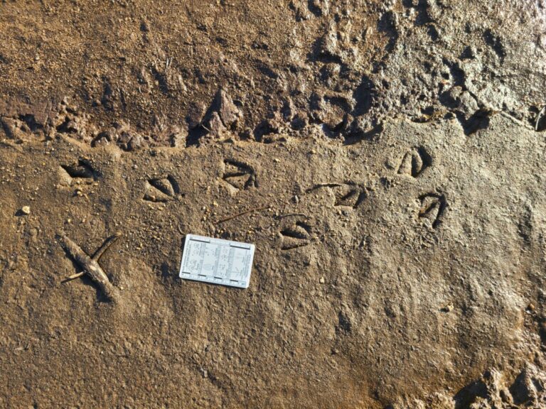
After enjoying the bear tracks I walked back up to the forest edge where again I encountered an abundance of mouse and grouse tracks. The abundant mouse tracks made sense to me, and the mice appeared to go back and forth between favored spots. However, I remain a little puzzled by the number of grouse tracks. They were mostly going in one direction, not back and forth like the mice. Perhaps they went one direction on the sand then repeated the process the next morning? I often only see one or two grouse together in the fall, but perhaps these were a small remnant of a summer brood. Or is there some other species I’m forgetting? Let me know what you think.
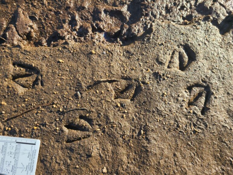
In this and the next image I was documenting that the grouse walked under this down tree limb with only about 10 inches of clearance.
Grouse walking under down tree limb.
Grouse tracks
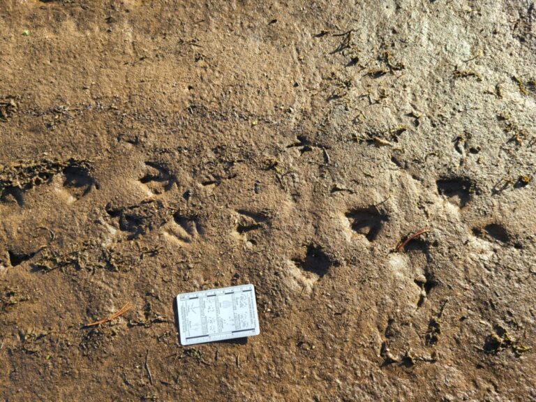
Mouse tracks. It appears the mouse jumped up onto the rock above and to the right of the card to launch itself along its path.
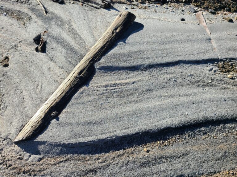
A dead lodgepole pine twig makes its own mark in the sand.
Grouse and mouse tracks.
Mouse and grouse tracks.
Grouse and mouse tracks.
Mouse tracks.
The sun was on its way to getting low, so I evaluated my progress and plans. I decided to make one more push to another area of adjacent mud and sand. I first walked through an area of dried, cracked mud, whose shapes and shadows mesmerized me.
In some of the partly dried mud were some older tracks of a passerine. I first considered American Pipit as this is certainly their habitat this time of year, and the bird was walking not hopping or skipping like a junco or sparrow. I was concerned that the claw on the rear toe (#1) seems to be rather close to the tip of the toe, not elongated as in a pipit. However, I checked the track against photos I have after watching pipits in similar substrate and they look very similar. Let me know what you think.
Passerine prints, probably American Pipit. In the drier substrate, the rear toe (#1) shows up as a dot and the claw as a smaller dot just behind it.
Passerine prints, probably American Pipit. In the drier substrate, the rear toe (#1) shows up as a dot and the claw as a smaller dot just behind it.
Passerine prints, probably American Pipit. In the drier substrate, the rear toe (#1) shows up as a dot and the claw as a smaller dot just behind it.
Passerine prints, probably American Pipit. In this wetter substrate, the rear toe (#1) shows up in full.
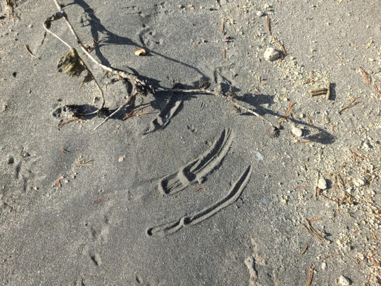
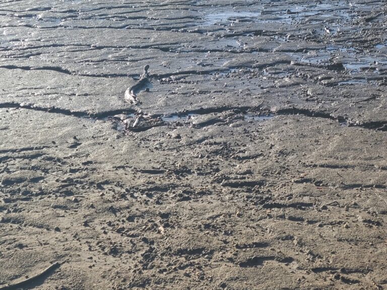
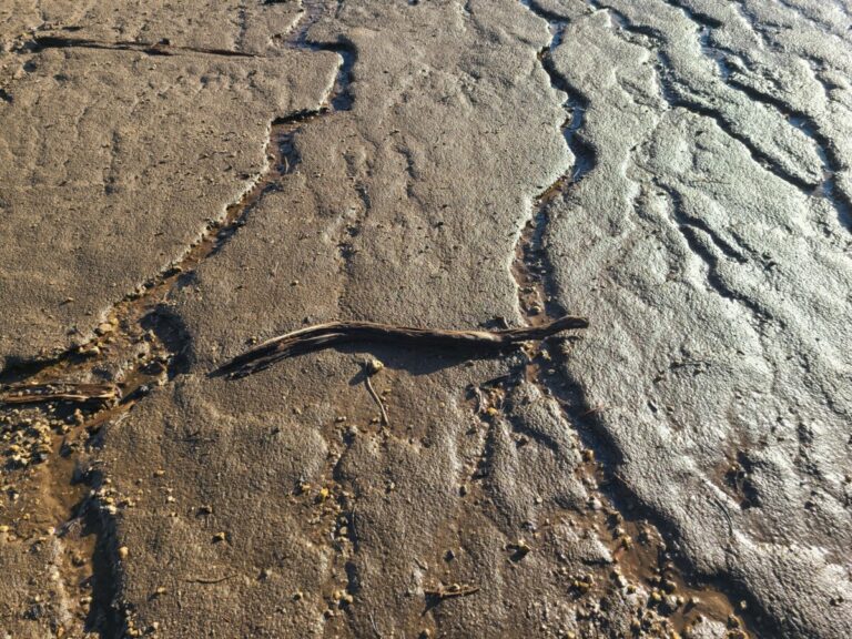
I thought I would then venture into an area of visibly moist mud, as I could see some tracks from a distance. However, I was momentarily delayed by the spotting of a “mud serpent.”
The mudflat I was venturing into, with the "mud serpent" just left of center.
Zoomed in on the "mud serpent."
Oh, it's just a stick. But look, it's even got its head up!
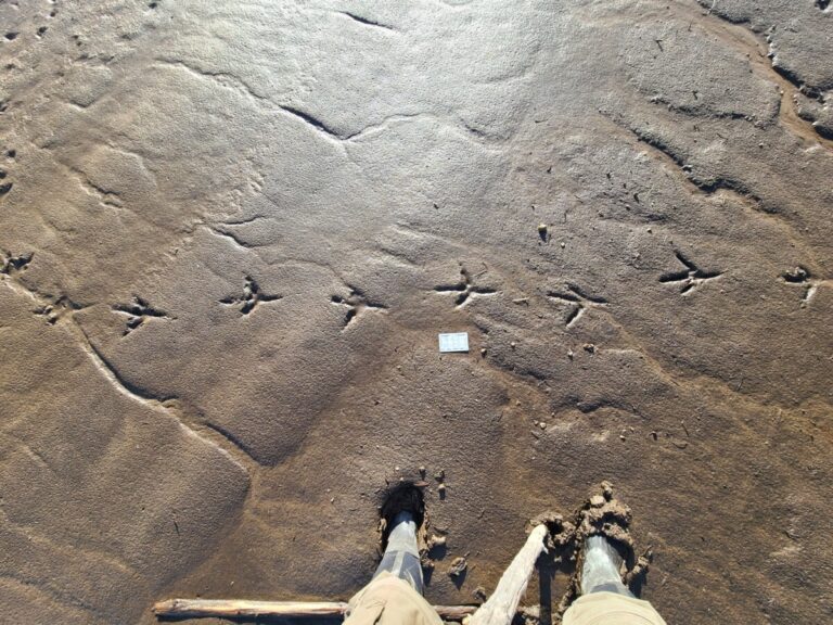
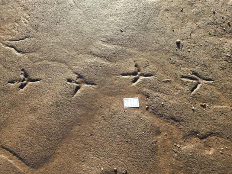
Once I overcame my imagination of the serpent, I continued on my journey into the mire and much, which was a bit of a challenge. The prints I found appeared to be a small duck, possibly a Green-winged Teal, and some Great Blue Heron tracks.
Me sinking in the mud while observing Great Blue Heron tracks.
Great Blue Heron tracks.
Great Blue Heron tracks.
Small duck tracks, probably Green-winged Teal.
Small duck tracks, probably Green-winged Teal.
Small duck tracks, probably Green-winged Teal. Passerine tracks just above the duck tracks.
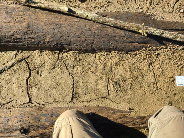
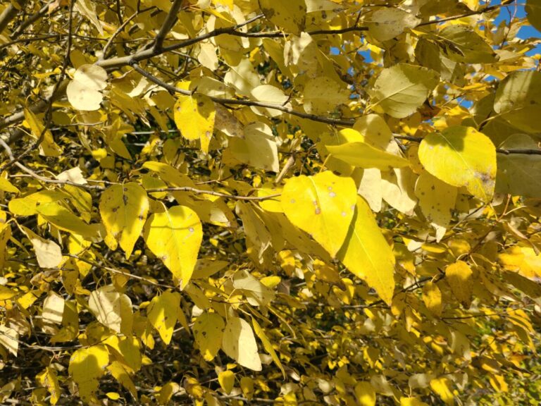
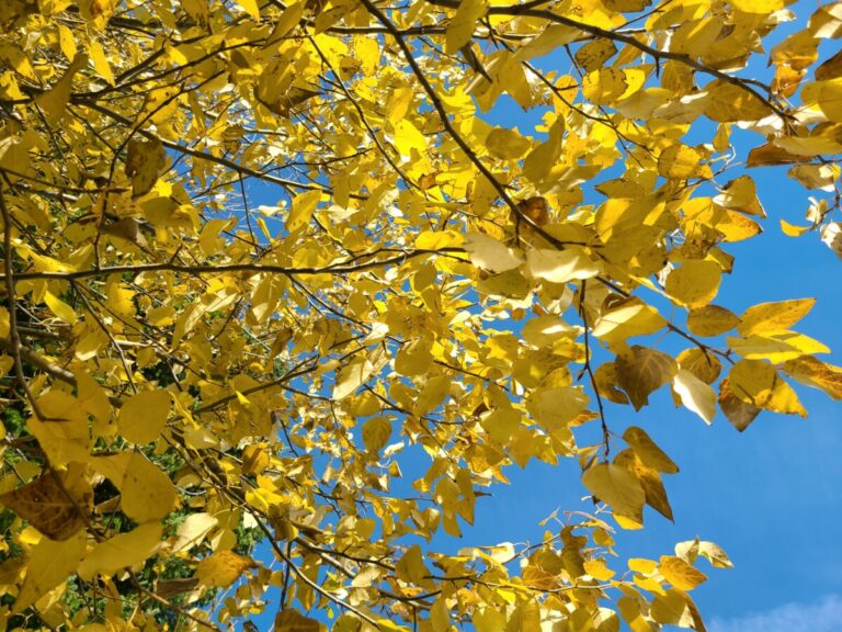
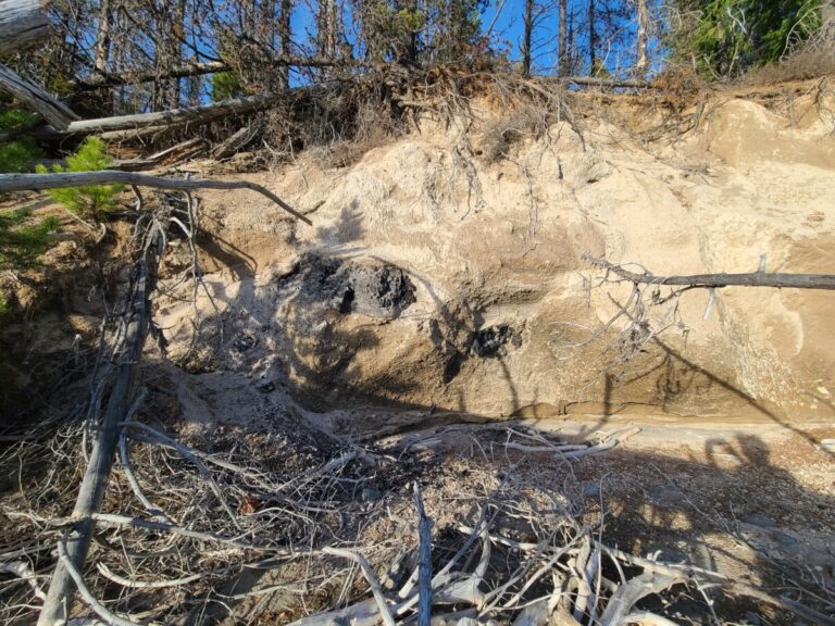
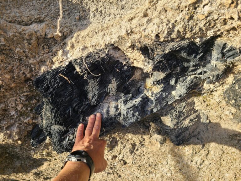
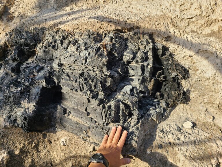
Now, the sun was getting low, and I decided it would be best that I not get stuck and spend the night in the mud, so I ventured my way out with a few extra pounds of weight on my boots. On my walk back to the pickup, a very yellow young Black Cottonwood glowed in the low light, and 7,000-year-old charred logs protruded from the ash/pumice bank of the lake reminding me of the ancient history of the area. I had enjoyed an exhilarating day exploring two small areas representing a small fraction of the exposed lakebed at Lemolo Lake. The possibilities were endless and future trips danced in my dreams.
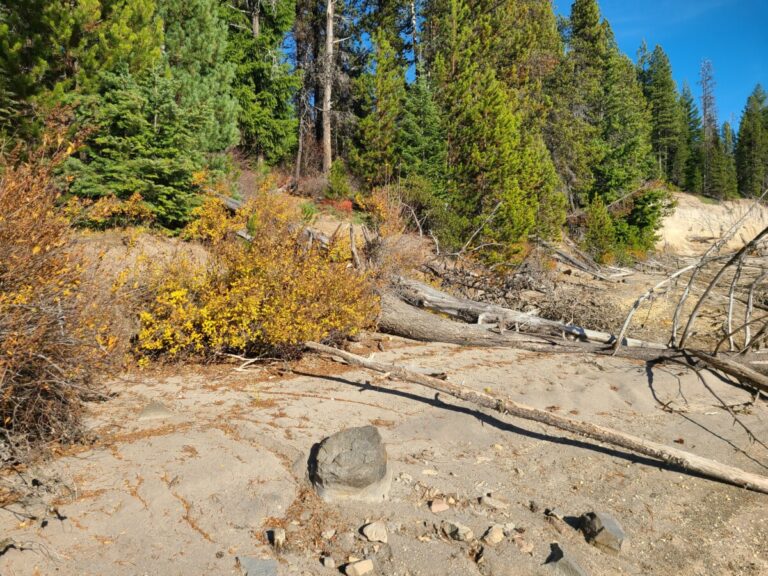
Fall colors of a small Black Cottonwood tree along the banks of Lemolo Lake.
Fall colors of a small Black Cottonwood tree along the banks of Lemolo Lake.
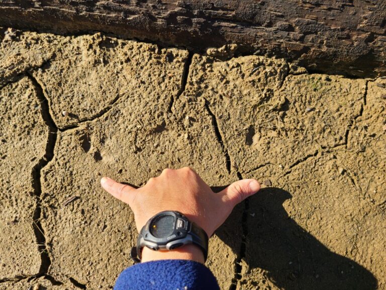
7,000-year-old charred logs in Mazama ash/pumice.
7,000-year-old charred log in Mazama ash/pumice.
7,000-year-old charred log in Mazama ash/pumice.
Species of tracks or sign observed (* also observed at River Forks Park): American Black Bear Northern River Otter Coyote (possibly) Black-tailed Deer (deer*) Virginia Opossum Deer Mouse Green-winged Teal Medium-sized duck species* Great Blue Heron* Spotted Sandpiper* Grouse (probably Ruffed) Pileated Woodpecker Common Raven American Pipit (Passerine*) Domestic dog* Human* A spruce gall aphid (Adelges sp.)
If you have insights about what I saw, please share in the comments below! Thank-you!
Nice report Matt! I have spent a lot of time on and near Lemolo Lake in the course of my work on the Forest, but not ever snooped around on the shores after the drawdown!! Thanks so much for sharing your knowledge and thoughts about the tracks! The reality of the Mount Mazama charred wood always blows me away and that is a magnificent example!! Was it in the pumice bluff you pointed out in one of the lake photos? Love your reports! Thanks again.
So much activity going on! I wonder if I were to sit quietly for hours (if I am able to do it) I would be able to see them passing by! I guess it would be possible! I only wish I had the opportunity to actually do it!

This Post Has 4 Comments
Fascinating as always, Matt. Thanks for sharing.
Nice report Matt! I have spent a lot of time on and near Lemolo Lake in the course of my work on the Forest, but not ever snooped around on the shores after the drawdown!! Thanks so much for sharing your knowledge and thoughts about the tracks! The reality of the Mount Mazama charred wood always blows me away and that is a magnificent example!! Was it in the pumice bluff you pointed out in one of the lake photos? Love your reports! Thanks again.
So much activity going on! I wonder if I were to sit quietly for hours (if I am able to do it) I would be able to see them passing by! I guess it would be possible! I only wish I had the opportunity to actually do it!
No insights here, but we have been there when there has been a water drawdown but didn’t really look at tracks. Love your pictures.