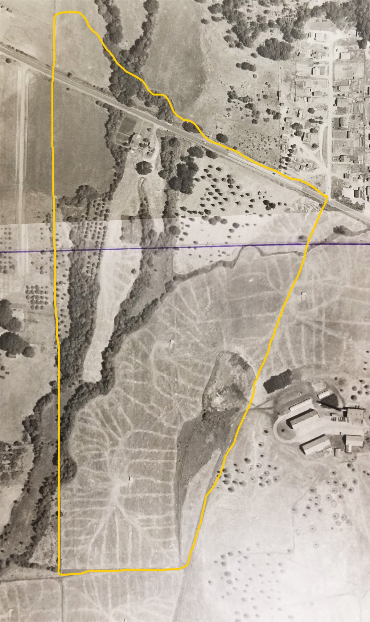
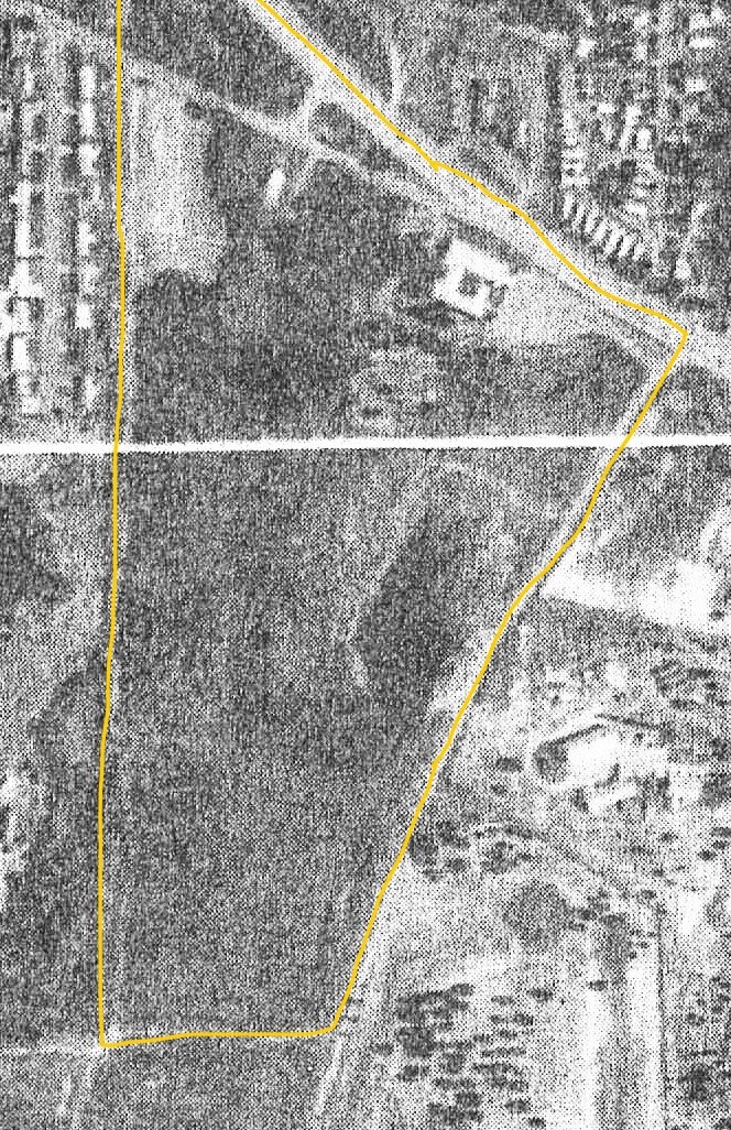
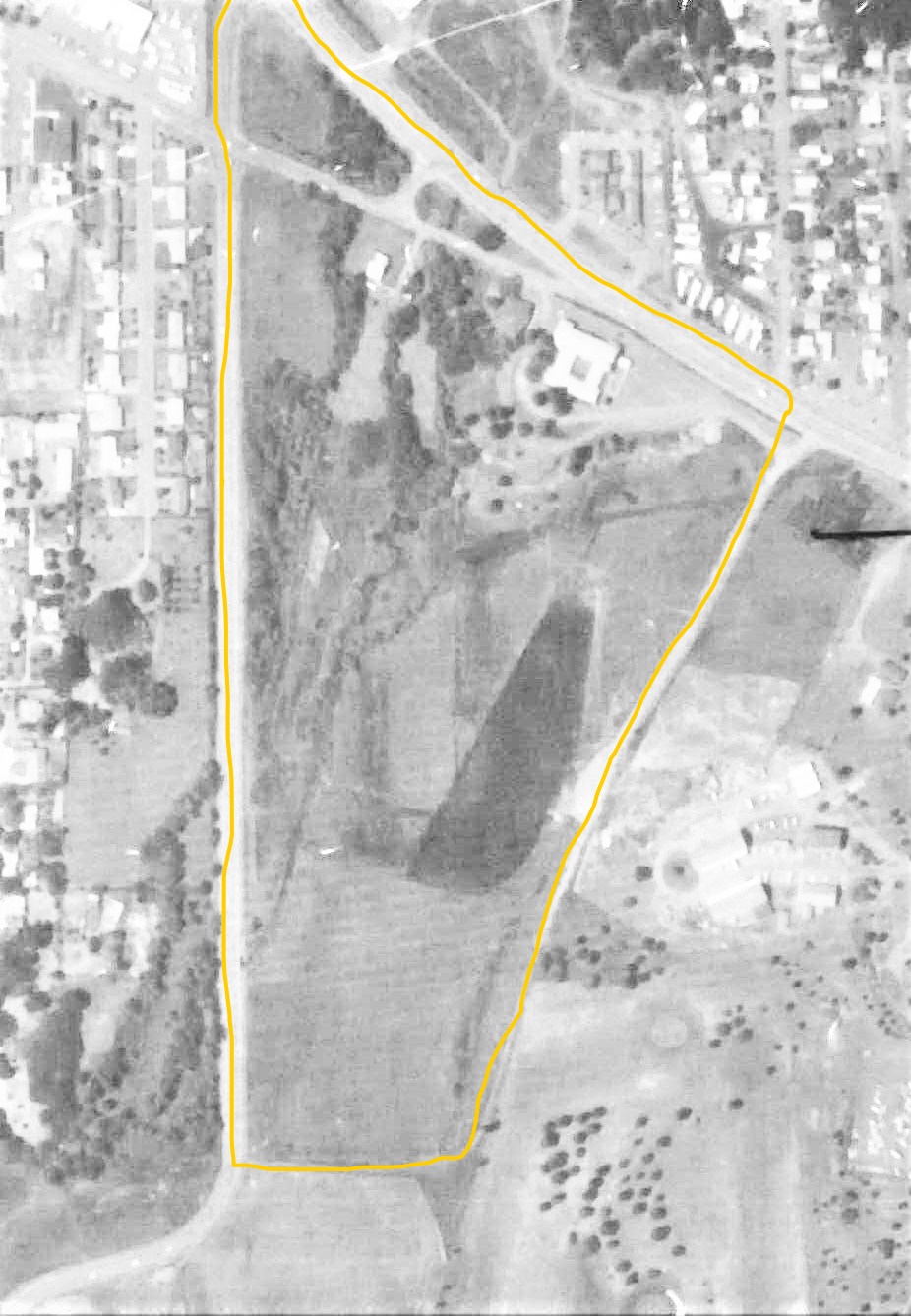
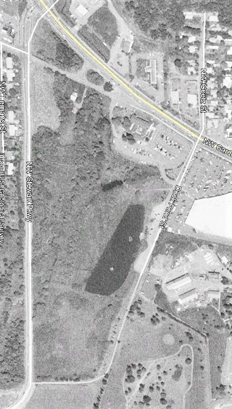
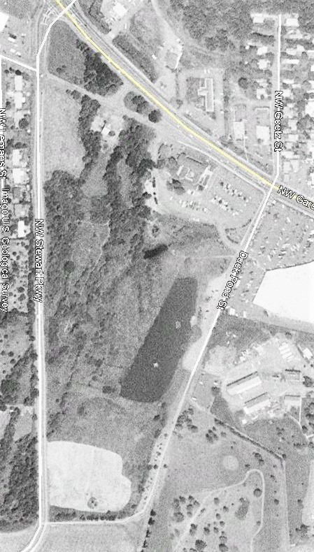
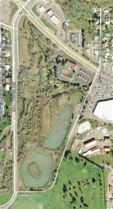
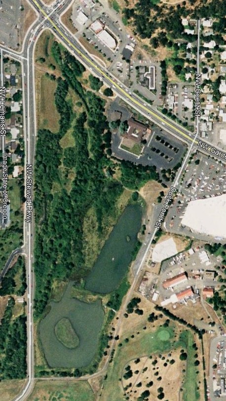
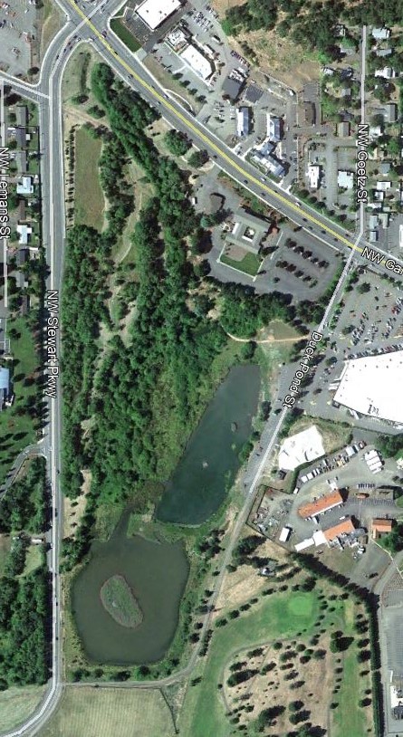
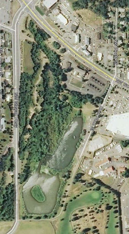
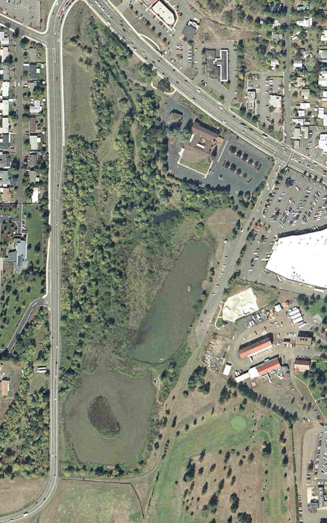
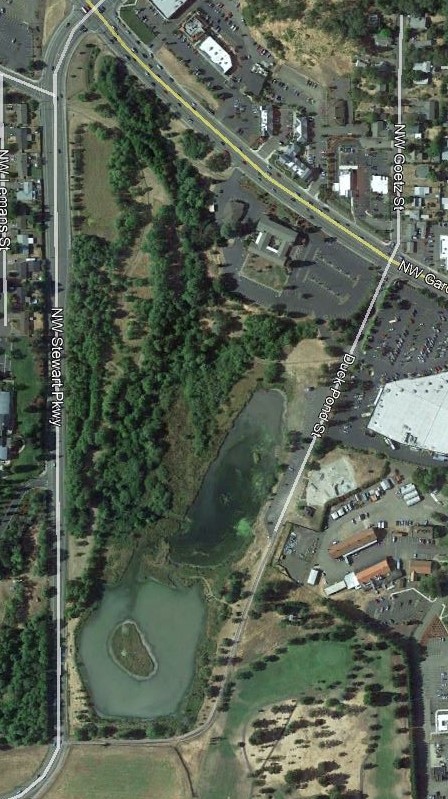
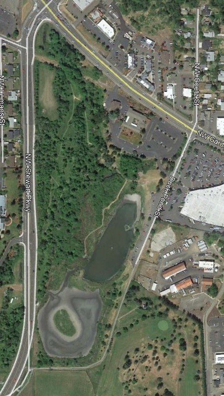
The yellow outline in each photo represents the modern boundary of the Stewart Park Wildlife Area (anyone know what the lines in the field are?). In the 1950 photo the main street going diagonally from NW to SE is Garden Valley Blvd. The riparian zone of Newton Creek and small tributaries can be seen, as well as the original homestead (just left of top center below Garden Valley Blvd), several orchards, and the beginnings of the VA campus (just below right center). In the rather poor photo on the right from sometime in the 1970s, several changes can be seen: Garden Valley Blvd is now wider and curves to head a bit more NW; the Seventh Day Adventist Church is present, as well as its parking lot; most of the orchards appear to be gone; rows of houses are present in the NW part of the photo; pines on the VA campus have grown significantly; there is now a road that will become the road into the pond parking area, and it looks like the main pond may have been installed, possibly with the north end being shallower and including some emergent vegetation (but it’s hard to tell). Also not sure, but the golf course may be crudely installed.


This Post Has 7 Comments
Does anyone know if either the north or south pond were for “wetland mitigation” … enhanced for wildlife by some corporation who wanted to destroy a wetland elsewhere? I believe that practice started with the clean water act in 1972, which is about when the north pond went in.
I’m told parts of the south pond (e.g. the center island and the wet areas east and south of the pond proper) were part of wetland mitigation. I think the north pond was just put in as a pond.
Thanks Elva. Yes, new signage is for education. I’m doing some investigation and inquiry to get more educated myself. Will report back later. I’ve felt as you do, that for some, feeding the ducks is their connection with nature. But ODFW and Umpqua Wildlife Rescue both get several calls per year regarding injured and sick waterfowl at the ponds. The water quality with the current huge numbers of waterfowl is of concern (but I’m hoping we can get some data). Much of the topsoil has eroded into the pond where most feeding takes place. Looking for information and solutions. The path on the west side of the pond was for City access to repair some breaches to dikes by nutria, which resulted in the near dry ponds last year. The path will probably grow back to previous vegetation and better warning signs regarding nesting birds will likely be installed from what I can gather. There is a contracted trapper live-trapping and removing nutria, which will be a never-ending process.
Wonderful work Matt. Good points by Elva and Mikeal on wildlife and feeding them. I remember walking around the pond in the early 80’s. My middle son, about 3 yo, fell into a drainage ditch on the west side of the pond. It was about 3 ft deep or more. He had completely disappeared , we could barely hear him crying and took about 20 tense seconds to find him. I had to lay on the ground and reach as far as I could to grab him and pull him out. Not sure what these ditches did but probably to drain the wet soil to allow access, so kids could fall into the ditches. 😉
Great story Mark! 🙂 Those deep ditches on the west side of the pond were created by two processes as far as I know: 1) storm-water comes in from the NE to the middle of the area (west of the north pond), then flows E and SE in multiple places toward the pond and this input over time likely created some channels. 2) Nutria may have dug burrows back into the west banks of the pond and over time these collapsed, creating larger gullies for the storm water runoff to erode even more deeply.
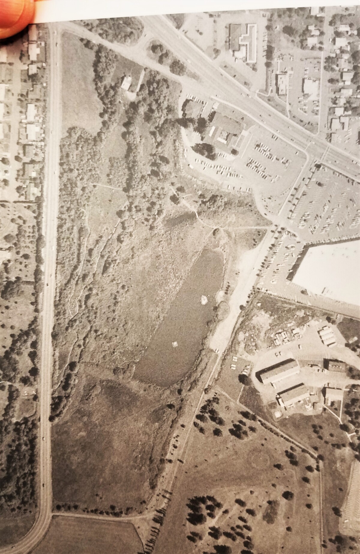
Thank you Matt, for a journey back in time and memory. The changes visible from above in the Stewart Park Wildlife Area (always so much more than a duck pond) recall so many memories of people from Umpqua Valley Audubon, Oregon Department of Fish and Wildlife, and other groups and agencies, Roseburg and Douglas County. Trails and footbridges were built, trash picked up, all the while with many walks and programs that told people of all ages about birds and other wildlife. I worked for the Umpqua National Forest in the 1980s in downtown Roseburg’s old Post Office and federal building at the corner of SE Cass and Stephens, and after 1983 at NW Stewart Parkway and Edenbower. I mention that because the Forest Service and USDA managed the Fred Meyer property then, adjacent to the Roseburg Veteran’s Administration. I remember trying to find a quiet place away from the office to work in an unheated greenhouse (visible in the 1977 June 8 photo I think, just below the black line along the NW tributary to Newton Creek). It was too cold to sit and write there, and before 1990 the Forest Service negotiated the trade of that property for private land within the Umpqua National Forest boundary. The Roseburg property was then sold to Fred Meyer for the store and parking area. I was on the Roseburg City Planning Commission after that. I remember the commission and staff considered routing the Fred Meyer parking area rain water runoff around the pond, but finally settling for catch basins with oil traps (which require cleaning) on storm drains that empty into the north pond. In the larger picture, building a joint entrance into Fred Meyer and the Stewart Park pond parking area greatly increased use of the pond, wildlife awareness (especially waterfowl and other aquatic life), and environmental pressure on the wildlife pond and habitat between the VA and Stewart Parkway. Fred Meyer was one of the first large chain stores in Roseburg, favored by many. That encouraged compromises like the joint entrance road on city of Roseburg property (important for a big store on a small lot), which led to costs and benefits for people and wildlife alike.
Finally, Matt’s question on Umpqua Birds email list about Stewart pond duck and other wildlife feeding history has interesting facets that affect the wildlife area, people enjoyment and wildlife awareness, and philosophy. Animals entertain and teach us when we see them. We are taught about birdies, bunnies and kitties as children, by adults who may know a lot or a little about wildlife. We get the good with the bad. It’s important to think about whether we feed animals for them or for us (both can help or hurt), and whether animals think the way we do or at all (at least in the way we do). White bread ballooning the bellies of ducks or elk forage trucked in after a freak snowfall are the result of what we think is best, and different people and wildlife might react differently. I’m not sure what I think, but I do think it’s complicated and extends to pet ownership, animal welfare, animal control, endangered species and how we treat the habitat we share with other species.
I think it’s good to ask ourselves if what we do for animals is for them or for us. Just thinking about that is a start. Digging into the history of the Stewart Park Wildlife Area is important and fun, and I hope to read more about it.
Wow, fantastic history and important perspectives Mikeal. Thank-you.